Area Overview for SW16 6SA
Photos of SW16 6SA
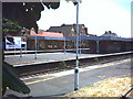
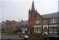
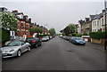
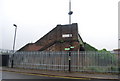
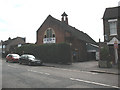
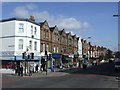
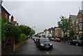
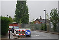
98 photos from this area
Area Information
Key information about the SW16 6SA including its size, population, and administrative classification.
- Area Type
- Postcode
- Area Size
- 2141 m²
- Population
- 1734
- Population Density
- 13718 people/km²
House Prices in SW16 6SA
17
Properties
£254,483
Average Sold Price
£123,300
Lowest Price
£515,000
Highest Price
Showing 17 properties
| Address | Type | Beds | Baths | Last Sale Price | Last Sale Date | |
|---|---|---|---|---|---|---|
| 30 Moyser Road, London, SW16 6SA | Maisonette | - | - | £515,000 | May 2024 | |
| 28A Moyser Road, London, SW16 6SA | Flat | 3 | 1 | £353,500 | Mar 2023 | |
| 24A Moyser Road, London, SW16 6SA | Flat | 1 | - | £265,000 | Oct 2019 | |
| 20A Moyser Road, London, SW16 6SA | Flat | - | - | £329,000 | Jun 2016 | |
| 34 Moyser Road, London, SW16 6SA | Flat | 3 | 1 | £360,000 | Feb 2016 | |
| 20 Moyser Road, London, SW16 6SA | Flat | - | - | £265,000 | Nov 2015 | |
| 36 Moyser Road, London, SW16 6SA | Maisonette | 3 | - | £190,000 | Oct 2010 | |
| 26 Moyser Road, London, SW16 6SA | Flat | - | - | £185,000 | Oct 2006 | |
| 32 Moyser Road, London, SW16 6SA | Flat | - | - | £175,000 | Sep 2005 | |
| 18 Moyser Road, London, SW16 6SA | Flat | 1 | 1 | £134,000 | Apr 2004 |
Page 1 of 2
Energy Efficiency in SW16 6SA
Amenities
Schools
| Rank | School | Type | Entry gender | Ages |
|---|
Explore more schools in this area
Go to Schools tabDemographics
Household Size
Family (3-5 people)
most common
Accommodation Type
Houses
most common
Tenure
65
majority
Ethnic Group
White
most common
Religion
N/A
most common
Household Composition
N/A
most common
Age
47
median
Adults (30-64 years)
most common
Household Deprivation
N/A
with no deprivation
NS-SEC
47
in Lower managerial occupations
Explore more demographic insights in this area
Go to Demographics tabPlanning
Planning Constraints
- Flood RiskPremium
- Ramsar Wetland SitesPremium
- Area of Outstanding Natural BeautyPremium
- Protected Nature ReservePremium
- Protected WoodlandPremium