Area Overview for SW16 6NT
Photos of SW16 6NT

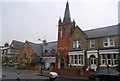
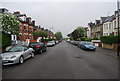
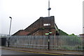
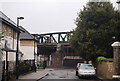
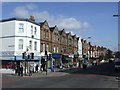
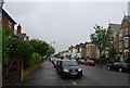
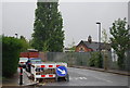
98 photos from this area
Area Information
Key information about the SW16 6NT including its size, population, and administrative classification.
- Area Type
- Postcode
- Area Size
- 1.3 hectares
- Population
- 1729
- Population Density
- 14765 people/km²
House Prices in SW16 6NT
36
Properties
£455,567
Average Sold Price
£87,500
Lowest Price
£817,500
Highest Price
Showing 36 properties
| Address | Type | Beds | Baths | Last Sale Price | Last Sale Date | |
|---|---|---|---|---|---|---|
| 220 Mitcham Lane, London, SW16 6NT | Terraced | 3 | 1 | £620,000 | Oct 2024 | |
| 210 Mitcham Lane, London, SW16 6NT | Terraced | 3 | - | £665,000 | Feb 2023 | |
| 208 Mitcham Lane, London, SW16 6NT | Terraced | 5 | 2 | £817,500 | Dec 2022 | |
| 228 Mitcham Lane, London, SW16 6NT | Terraced | 5 | 2 | £790,000 | Nov 2021 | |
| 188 Mitcham Lane, London, SW16 6NT | Terraced | 3 | 1 | £640,000 | Jan 2019 | |
| 196 Mitcham Lane, London, SW16 6NT | Terraced | 5 | - | £610,000 | Jan 2015 | |
| 190 Mitcham Lane, London, SW16 6NT | Terraced | 3 | - | £570,000 | Jul 2014 | |
| 204 Mitcham Lane, London, SW16 6NT | house | 5 | - | £470,000 | Sep 2013 | |
| 198 Mitcham Lane, London, SW16 6NT | Terraced | 6 | 2 | £323,500 | Oct 2007 | |
| 182 Mitcham Lane, London, SW16 6NT | Terraced | - | - | £307,000 | Jan 2007 |
Page 1 of 4
Energy Efficiency in SW16 6NT
Amenities
Schools
| Rank | School | Type | Entry gender | Ages |
|---|
Explore more schools in this area
Go to Schools tabDemographics
Household Size
Family (3-5 people)
most common
Accommodation Type
Flats
most common
Tenure
53
majority
Ethnic Group
White
most common
Religion
N/A
most common
Household Composition
N/A
most common
Age
47
median
Adults (30-64 years)
most common
Household Deprivation
N/A
with no deprivation
NS-SEC
41
in Lower managerial occupations
Explore more demographic insights in this area
Go to Demographics tabPlanning
Planning Constraints
- Flood RiskPremium
- Ramsar Wetland SitesPremium
- Area of Outstanding Natural BeautyPremium
- Protected Nature ReservePremium
- Protected WoodlandPremium