Area Overview for SW16 5PG
Photos of SW16 5PG
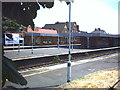
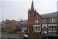
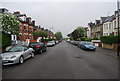
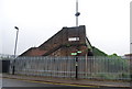
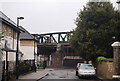
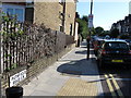
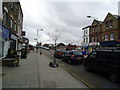
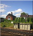
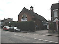
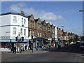
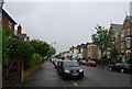
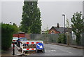
98 photos from this area
Area Information
Key information about the SW16 5PG including its size, population, and administrative classification.
- Area Type
- Postcode
- Area Size
- 8408 m²
- Population
- 1618
- Population Density
- 14894 people/km²
House Prices in SW16 5PG
44
Properties
£554,536
Average Sold Price
£41,000
Lowest Price
£1,115,000
Highest Price
Showing 44 properties
| Address | Type | Beds | Baths | Last Sale Price | Last Sale Date | |
|---|---|---|---|---|---|---|
| 60 Barrow Road, London, SW16 5PG | Terraced | 5 | 1 | £974,000 | Jul 2025 | |
| 56 Barrow Road, London, SW16 5PG | house | - | - | £792,500 | Feb 2022 | |
| 52 Barrow Road, London, SW16 5PG | Semi-detached | 5 | 2 | £1,035,000 | Mar 2019 | |
| 68 Barrow Road, London, SW16 5PG | Maisonette | 3 | - | £1,115,000 | Feb 2016 | |
| 58 Barrow Road, London, SW16 5PG | house | 4 | - | £800,000 | Jul 2015 | |
| 92 Barrow Road, London, SW16 5PG | house | - | - | £681,000 | Aug 2013 | |
| 64 Barrow Road, London, SW16 5PG | house | 5 | 2 | £500,000 | Nov 2006 | |
| 66 Barrow Road, London, SW16 5PG | Semi-detached | 5 | 2 | £465,000 | Apr 2006 | |
| 50 Barrow Road, London, SW16 5PG | hospital_care_home | - | - | £480,000 | Dec 2003 | |
| 90 Barrow Road, London, SW16 5PG | Semi-detached | - | - | £330,000 | Aug 2003 |
Page 1 of 5
Energy Efficiency in SW16 5PG
Amenities
Schools
| Rank | School | Type | Entry gender | Ages |
|---|
Explore more schools in this area
Go to Schools tabDemographics
Household Size
Family (3-5 people)
most common
Accommodation Type
Flats
most common
Tenure
42
majority
Ethnic Group
White
most common
Religion
N/A
most common
Household Composition
N/A
most common
Age
47
median
Adults (30-64 years)
most common
Household Deprivation
N/A
with no deprivation
NS-SEC
44
in Lower managerial occupations
Explore more demographic insights in this area
Go to Demographics tabPlanning
Planning Constraints
- Flood RiskPremium
- Ramsar Wetland SitesPremium
- Area of Outstanding Natural BeautyPremium
- Protected Nature ReservePremium
- Protected WoodlandPremium