Area Overview for SW16 5EL
Photos of SW16 5EL
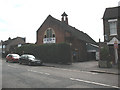
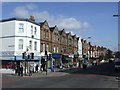
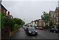
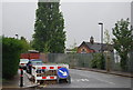
98 photos from this area
Area Information
Key information about the SW16 5EL including its size, population, and administrative classification.
- Area Type
- Postcode
- Area Size
- 4209 m²
- Population
- 1507
- Population Density
- 10889 people/km²
House Prices in SW16 5EL
19
Properties
£229,167
Average Sold Price
£62,500
Lowest Price
£547,500
Highest Price
Showing 19 properties
| Address | Type | Beds | Baths | Last Sale Price | Last Sale Date | |
|---|---|---|---|---|---|---|
| 87 Sherwood Avenue, London, SW16 5EL | Terraced | 4 | 2 | £475,000 | Sep 2018 | |
| 91 Sherwood Avenue, London, SW16 5EL | Terraced | 3 | 1 | £547,500 | Mar 2016 | |
| 97 Sherwood Avenue, London, SW16 5EL | Terraced | - | - | £300,000 | Mar 2008 | |
| 75 Sherwood Avenue, London, SW16 5EL | Terraced | - | - | £235,000 | Aug 2007 | |
| 103 Sherwood Avenue, London, SW16 5EL | house | - | - | £236,000 | Mar 2007 | |
| 85 Sherwood Avenue, London, SW16 5EL | house | - | - | £190,000 | Jun 2003 | |
| 101 Sherwood Avenue, London, SW16 5EL | Terraced | 5 | 2 | £199,500 | Nov 2002 | |
| 105 Sherwood Avenue, London, SW16 5EL | Detached | 4 | - | £156,000 | Jun 2002 | |
| 77 Sherwood Avenue, London, SW16 5EL | house | - | - | £167,000 | Sep 2001 | |
| 109 Sherwood Avenue, London, SW16 5EL | Terraced | - | - | £62,500 | Dec 1999 |
Page 1 of 2
Energy Efficiency in SW16 5EL
Amenities
Schools
| Rank | School | Type | Entry gender | Ages |
|---|
Explore more schools in this area
Go to Schools tabDemographics
Household Size
Family (3-5 people)
most common
Accommodation Type
Houses
most common
Tenure
68
majority
Ethnic Group
White
most common
Religion
N/A
most common
Household Composition
N/A
most common
Age
47
median
Adults (30-64 years)
most common
Household Deprivation
N/A
with no deprivation
NS-SEC
32
in Lower managerial occupations
Explore more demographic insights in this area
Go to Demographics tabPlanning
Planning Constraints
- Flood RiskPremium
- Ramsar Wetland SitesPremium
- Area of Outstanding Natural BeautyPremium
- Protected Nature ReservePremium
- Protected WoodlandPremium