Area Overview for SW16 5DD
Photos of SW16 5DD
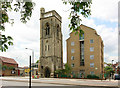
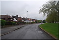
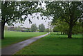
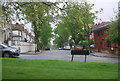
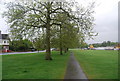
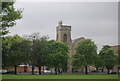
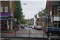
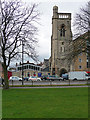
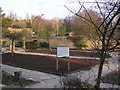
100 photos from this area
Area Information
Key information about the SW16 5DD including its size, population, and administrative classification.
- Area Type
- Postcode
- Area Size
- 1.4 hectares
- Population
- 2072
- Population Density
- 11706 people/km²
House Prices in SW16 5DD
45
Properties
£391,145
Average Sold Price
£43,500
Lowest Price
£790,000
Highest Price
Showing 45 properties
| Address | Type | Beds | Baths | Last Sale Price | Last Sale Date | |
|---|---|---|---|---|---|---|
| 136 Ellison Road, London, SW16 5DD | house | 3 | 1 | £755,000 | Jul 2022 | |
| 154 Ellison Road, London, SW16 5DD | Semi-detached | 3 | 1 | £790,000 | Jun 2022 | |
| 150 Ellison Road, London, SW16 5DD | Semi-detached | 3 | - | £782,000 | Dec 2020 | |
| 114 Ellison Road, London, SW16 5DD | house | 3 | 1 | £665,000 | Aug 2020 | |
| 94 Ellison Road, London, SW16 5DD | Semi-detached | 3 | 1 | £750,000 | Nov 2019 | |
| 90 Ellison Road, London, SW16 5DD | Semi-detached | 4 | 3 | £755,000 | Dec 2017 | |
| 92 Ellison Road, London, SW16 5DD | house | - | - | £770,000 | Sep 2016 | |
| 106 Ellison Road, London, SW16 5DD | Semi-detached | 3 | 1 | £520,000 | Jul 2015 | |
| 82 Ellison Road, London, SW16 5DD | Terraced | 2 | 1 | £600,000 | Jun 2015 | |
| 88 Ellison Road, London, SW16 5DD | Semi-detached | 3 | - | £705,000 | Dec 2014 |
Page 1 of 5
Energy Efficiency in SW16 5DD
Amenities
Schools
| Rank | School | Type | Entry gender | Ages |
|---|
Explore more schools in this area
Go to Schools tabDemographics
Household Size
Family (3-5 people)
most common
Accommodation Type
Flats
most common
Tenure
48
majority
Ethnic Group
White
most common
Religion
N/A
most common
Household Composition
N/A
most common
Age
47
median
Adults (30-64 years)
most common
Household Deprivation
N/A
with no deprivation
NS-SEC
37
in Lower managerial occupations
Explore more demographic insights in this area
Go to Demographics tabPlanning
Planning Constraints
- Flood RiskPremium
- Ramsar Wetland SitesPremium
- Area of Outstanding Natural BeautyPremium
- Protected Nature ReservePremium
- Protected WoodlandPremium