Area Overview for SW16 4UZ
Photos of SW16 4UZ

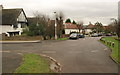
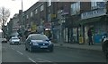
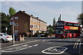
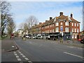
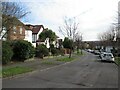
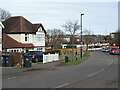
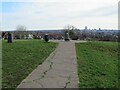
90 photos from this area
Area Information
Key information about the SW16 4UZ including its size, population, and administrative classification.
- Area Type
- Postcode
- Area Size
- 7210 m²
- Population
- 1575
- Population Density
- 4933 people/km²
House Prices in SW16 4UZ
27
Properties
£172,794
Average Sold Price
£50,000
Lowest Price
£300,000
Highest Price
Showing 27 properties
| Address | Type | Beds | Baths | Last Sale Price | Last Sale Date | |
|---|---|---|---|---|---|---|
| 16 Somerset Gardens, Norbury, London, SW16 4UZ | Maisonette | - | - | £182,000 | Aug 2023 | |
| 4 Somerset Gardens, Norbury, London, SW16 4UZ | Maisonette | 2 | 1 | £275,000 | Jan 2020 | |
| 2 Somerset Gardens, Norbury, London, SW16 4UZ | Flat | - | - | £300,000 | Sep 2016 | |
| 23 Somerset Gardens, Norbury, London, SW16 4UZ | Maisonette | - | - | £299,000 | Mar 2016 | |
| 28 Somerset Gardens, Norbury, London, SW16 4UZ | Maisonette | - | - | £295,000 | Mar 2016 | |
| 17 Somerset Gardens, Norbury, London, SW16 4UZ | house | - | - | £153,000 | Apr 2010 | |
| 7 Somerset Gardens, Norbury, London, SW16 4UZ | Maisonette | - | - | £120,000 | Oct 2008 | |
| 21 Somerset Gardens, Norbury, London, SW16 4UZ | Flat | - | - | £125,000 | Jul 2008 | |
| 15 Somerset Gardens, Norbury, London, SW16 4UZ | Maisonette | 2 | 1 | £192,000 | Aug 2007 | |
| 9 Somerset Gardens, Norbury, London, SW16 4UZ | Maisonette | - | - | £175,000 | Sep 2006 |
Page 1 of 3
Energy Efficiency in SW16 4UZ
Amenities
Schools
| Rank | School | Type | Entry gender | Ages |
|---|
Explore more schools in this area
Go to Schools tabDemographics
Household Size
Family (3-5 people)
most common
Accommodation Type
Houses
most common
Tenure
73
majority
Ethnic Group
asian_total
most common
Religion
N/A
most common
Household Composition
N/A
most common
Age
47
median
Adults (30-64 years)
most common
Household Deprivation
N/A
with no deprivation
NS-SEC
39
in Lower managerial occupations
Explore more demographic insights in this area
Go to Demographics tabPlanning
Planning Constraints
- Flood RiskPremium
- Ramsar Wetland SitesPremium
- Area of Outstanding Natural BeautyPremium
- Protected Nature ReservePremium
- Protected WoodlandPremium