Area Overview for SW16 4RW
Photos of SW16 4RW
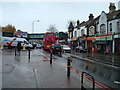
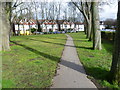
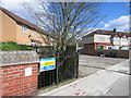
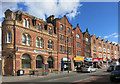
85 photos from this area
Area Information
Key information about the SW16 4RW including its size, population, and administrative classification.
- Area Type
- Postcode
- Area Size
- 3.7 hectares
- Population
- 1731
- Population Density
- 7516 people/km²
House Prices in SW16 4RW
17
Properties
£459,945
Average Sold Price
£154,950
Lowest Price
£1,570,000
Highest Price
Showing 17 properties
| Address | Type | Beds | Baths | Last Sale Price | Last Sale Date | |
|---|---|---|---|---|---|---|
| 50 Craignish Avenue, Norbury, London, SW16 4RW | Semi-detached | 3 | 1 | £640,000 | Apr 2025 | |
| 46 Craignish Avenue, Norbury, London, SW16 4RW | Semi-detached | 3 | 1 | £480,000 | Jan 2019 | |
| 53 Craignish Avenue, Norbury, London, SW16 4RW | Semi-detached | 3 | 1 | £520,000 | Jul 2017 | |
| 47 Craignish Avenue, Norbury, London, SW16 4RW | Semi-detached | 4 | 3 | £281,000 | Apr 2013 | |
| 45 Craignish Avenue, Norbury, London, SW16 4RW | Semi-detached | 4 | 3 | £365,000 | Nov 2012 | |
| 51 Craignish Avenue, Norbury, London, SW16 4RW | house | - | - | £252,500 | Jun 2005 | |
| Norbury Hall, 55 Craignish Avenue, Norbury, London, SW16 4RW | Retirement | - | - | £1,570,000 | Dec 2002 | |
| 49 Craignish Avenue, Norbury, London, SW16 4RW | Semi-detached | - | - | £164,000 | Jan 2001 | |
| 52 Craignish Avenue, Norbury, London, SW16 4RW | Semi-detached | - | - | £172,000 | Mar 2000 | |
| 54 Craignish Avenue, Norbury, London, SW16 4RW | Semi-detached | - | - | £154,950 | Nov 1998 |
Page 1 of 2
Energy Efficiency in SW16 4RW
Amenities
Schools
| Rank | School | Type | Entry gender | Ages |
|---|
Explore more schools in this area
Go to Schools tabDemographics
Household Size
Family (3-5 people)
most common
Accommodation Type
Houses
most common
Tenure
78
majority
Ethnic Group
White
most common
Religion
N/A
most common
Household Composition
N/A
most common
Age
47
median
Adults (30-64 years)
most common
Household Deprivation
N/A
with no deprivation
NS-SEC
35
in Lower managerial occupations
Explore more demographic insights in this area
Go to Demographics tabPlanning
Planning Constraints
- Flood RiskPremium
- Ramsar Wetland SitesPremium
- Area of Outstanding Natural BeautyPremium
- Protected Nature ReservePremium
- Protected WoodlandPremium