Area Overview for SW16 4HA
Photos of SW16 4HA

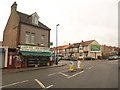
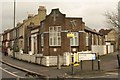


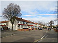
64 photos from this area
Area Information
Key information about the SW16 4HA including its size, population, and administrative classification.
- Area Type
- Postcode
- Area Size
- 1.3 hectares
- Population
- 1724
- Population Density
- 7707 people/km²
House Prices in SW16 4HA
53
Properties
£261,072
Average Sold Price
£74,000
Lowest Price
£510,000
Highest Price
Showing 53 properties
| Address | Type | Beds | Baths | Last Sale Price | Last Sale Date | |
|---|---|---|---|---|---|---|
| 48 Beckway Road, Streatham, London, SW16 4HA | Terraced | 3 | 1 | £450,000 | Aug 2023 | |
| 82 Beckway Road, Streatham, London, SW16 4HA | house | - | - | £510,000 | Dec 2020 | |
| 50 Beckway Road, Streatham, London, SW16 4HA | Semi-detached | 3 | 1 | £440,000 | Aug 2019 | |
| 80 Beckway Road, Streatham, London, SW16 4HA | Terraced | 3 | 1 | £427,000 | May 2019 | |
| 100 Beckway Road, Streatham, London, SW16 4HA | Detached | 3 | 1 | £510,000 | Aug 2017 | |
| 94 Beckway Road, Streatham, London, SW16 4HA | Terraced | 3 | 1 | £410,000 | Jul 2017 | |
| 60 Beckway Road, Streatham, London, SW16 4HA | Terraced | 3 | 1 | £410,000 | Feb 2017 | |
| 8 Beckway Road, Streatham, London, SW16 4HA | Terraced | 3 | 1 | £385,000 | Nov 2015 | |
| 22 Beckway Road, Streatham, London, SW16 4HA | Terraced | 3 | 1 | £420,000 | Aug 2015 | |
| 18 Beckway Road, Streatham, London, SW16 4HA | Terraced | 3 | 1 | £250,000 | Jul 2013 |
Page 1 of 6
Energy Efficiency in SW16 4HA
Amenities
Schools
| Rank | School | Type | Entry gender | Ages |
|---|
Explore more schools in this area
Go to Schools tabDemographics
Household Size
Family (3-5 people)
most common
Accommodation Type
Houses
most common
Tenure
73
majority
Ethnic Group
White
most common
Religion
N/A
most common
Household Composition
N/A
most common
Age
47
median
Adults (30-64 years)
most common
Household Deprivation
N/A
with no deprivation
NS-SEC
31
in Lower managerial occupations
Explore more demographic insights in this area
Go to Demographics tabPlanning
Planning Constraints
- Flood RiskPremium
- Ramsar Wetland SitesPremium
- Area of Outstanding Natural BeautyPremium
- Protected Nature ReservePremium
- Protected WoodlandPremium