Area Overview for SW16 2XW
Photos of SW16 2XW
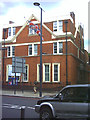
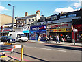
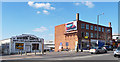
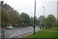
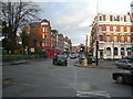
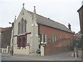
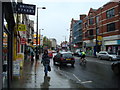
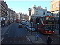
100 photos from this area
Area Information
Key information about the SW16 2XW including its size, population, and administrative classification.
- Area Type
- Postcode
- Area Size
- 2.1 hectares
- Population
- 1837
- Population Density
- 9459 people/km²
House Prices in SW16 2XW
81
Properties
£327,623
Average Sold Price
£79,500
Lowest Price
£675,000
Highest Price
Showing 81 properties
| Address | Type | Beds | Baths | Last Sale Price | Last Sale Date | |
|---|---|---|---|---|---|---|
| 50 Harborough Road, London, SW16 2XW | Maisonette | 4 | 1 | £645,000 | Feb 2025 | |
| 130 Harborough Road, London, SW16 2XW | Flat | 3 | - | £625,000 | Jul 2024 | |
| 102 Harborough Road, London, SW16 2XW | Flat | 3 | 1 | £575,000 | Sep 2023 | |
| 34 Harborough Road, London, SW16 2XW | Flat | - | - | £97,420 | Mar 2023 | |
| 110 Harborough Road, London, SW16 2XW | Flat | 2 | 1 | £675,000 | Nov 2022 | |
| 6 Harborough Road, London, SW16 2XW | Maisonette | 3 | 1 | £675,000 | May 2022 | |
| 22 Harborough Road, London, SW16 2XW | Flat | - | - | £455,000 | Mar 2022 | |
| 64A Harborough Road, London, SW16 2XW | Maisonette | 1 | 1 | £320,000 | Sep 2021 | |
| 30 Harborough Road, London, SW16 2XW | Flat | - | - | £627,277 | Dec 2020 | |
| 82 Harborough Road, London, SW16 2XW | Maisonette | 3 | 1 | £608,000 | Aug 2020 |
Page 1 of 9
Energy Efficiency in SW16 2XW
Amenities
Schools
| Rank | School | Type | Entry gender | Ages |
|---|
Explore more schools in this area
Go to Schools tabDemographics
Household Size
Family (3-5 people)
most common
Accommodation Type
Flats
most common
Tenure
52
majority
Ethnic Group
White
most common
Religion
N/A
most common
Household Composition
N/A
most common
Age
47
median
Adults (30-64 years)
most common
Household Deprivation
N/A
with no deprivation
NS-SEC
49
in Lower managerial occupations
Explore more demographic insights in this area
Go to Demographics tabPlanning
Planning Constraints
- Flood RiskPremium
- Ramsar Wetland SitesPremium
- Area of Outstanding Natural BeautyPremium
- Protected Nature ReservePremium
- Protected WoodlandPremium