Area Overview for SW16 2UX
Photos of SW16 2UX
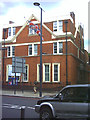
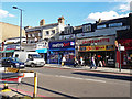

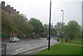
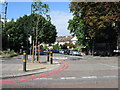
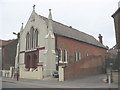
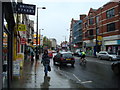
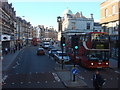
100 photos from this area
Area Information
Key information about the SW16 2UX including its size, population, and administrative classification.
- Area Type
- Postcode
- Area Size
- 8360 m²
- Population
- 1828
- Population Density
- 11079 people/km²
House Prices in SW16 2UX
34
Properties
£396,455
Average Sold Price
£68,000
Lowest Price
£865,000
Highest Price
Showing 34 properties
| Address | Type | Beds | Baths | Last Sale Price | Last Sale Date | |
|---|---|---|---|---|---|---|
| 19 Leithcote Gardens, London, SW16 2UX | Terraced | 4 | 3 | £865,000 | Jul 2025 | |
| 65 Leithcote Gardens, London, SW16 2UX | Semi-detached | 3 | 2 | £695,000 | Jan 2025 | |
| 31 Leithcote Gardens, London, SW16 2UX | Terraced | 4 | 2 | £857,500 | Jul 2024 | |
| 33 Leithcote Gardens, London, SW16 2UX | house | 3 | - | £640,000 | May 2024 | |
| 45 Leithcote Gardens, London, SW16 2UX | house | - | - | £732,500 | Jul 2021 | |
| 29 Leithcote Gardens, London, SW16 2UX | Terraced | 3 | 1 | £670,000 | Feb 2016 | |
| 39 Leithcote Gardens, London, SW16 2UX | Terraced | 3 | 1 | £430,000 | Sep 2013 | |
| 57 Leithcote Gardens, London, SW16 2UX | Terraced | 3 | - | £367,000 | Mar 2013 | |
| 15 Leithcote Gardens, London, SW16 2UX | house | 3 | - | £340,000 | Aug 2012 | |
| 49 Leithcote Gardens, London, SW16 2UX | house | - | - | £375,000 | Jun 2010 |
Page 1 of 4
Energy Efficiency in SW16 2UX
Amenities
Schools
| Rank | School | Type | Entry gender | Ages |
|---|
Explore more schools in this area
Go to Schools tabDemographics
Household Size
Family (3-5 people)
most common
Accommodation Type
Houses
most common
Tenure
58
majority
Ethnic Group
White
most common
Religion
N/A
most common
Household Composition
N/A
most common
Age
47
median
Adults (30-64 years)
most common
Household Deprivation
N/A
with no deprivation
NS-SEC
46
in Lower managerial occupations
Explore more demographic insights in this area
Go to Demographics tabPlanning
Planning Constraints
- Flood RiskPremium
- Ramsar Wetland SitesPremium
- Area of Outstanding Natural BeautyPremium
- Protected Nature ReservePremium
- Protected WoodlandPremium