Area Overview for SW16 1TJ
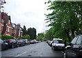
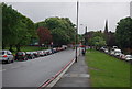
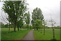
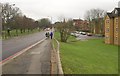
Photos of SW16 1TJ


Area Information
Living in SW16 1TJ means residing within a compact residential cluster defined by postcode SW16 1TJ. This specific area covers just 2910 square metres, creating a dense and contained environment for the 1,839 people who call it home. You will find this location is intensely populated, with a density that reaches 631,938 people per square kilometre. Such high concentration shapes the daily rhythm of living here, where immediate neighbours are often just steps away. The setting functions as a tightly knit residential hub where space is at a premium. Prospective buyers visiting SW16 1TJ should expect a neighbourhood built on proximity rather than sprawl. This specific postcode area offers a snapshot of urban living where infrastructure supports a significant population within a very small footprint. The character of SW16 1TJ is defined by this intense occupancy rate and the seamless integration of households into the surrounding transport network.
- Area Type
- Postcode
- Area Size
- 2910 m²
- Population
- 1839
- Population Density
- 13900 people/km²
The housing stock in SW16 1TJ is characterised by a specific skew towards flats. Accommodation type data confirms that flats are the predominant form of dwelling within this postcode. This feature defines the market for anyone looking at homes in SW16 1TJ. With a home ownership level of only 24%, the area functions significantly more as a rental market than an owner-occupied zone. This statistic is crucial for buyers considering SW16 1TJ. Most residents likely do not own their homes outright, which influences local investment dynamics and pricing stability. When searching for property here, you should prepare for predominantly flat layouts rather than detached or semi-detached houses. The small total area size of 2910 square metres restricts the availability of large footprint properties. Buyers needing conventional family homes will find limited stock within SW16 1TJ itself. The market is defined by this specific accommodation type and the relatively low percentage of ownership.
House Prices in SW16 1TJ
Showing 6 properties
| Address | Type | Beds | Baths | Last Sale Price | Last Sale Date | |
|---|---|---|---|---|---|---|
| 6, Tyers House, Aldrington Road, London, SW16 1TJ | Flat | - | - | - | - | |
| 3, Tyers House, Aldrington Road, London, SW16 1TJ | Flat | - | - | - | - | |
| 2, Tyers House, Aldrington Road, London, SW16 1TJ | Flat | - | - | - | - | |
| 5, Tyers House, Aldrington Road, London, SW16 1TJ | Flat | - | - | - | - | |
| 4, Tyers House, Aldrington Road, London, SW16 1TJ | Flat | - | - | - | - | |
| 1, Tyers House, Aldrington Road, London, SW16 1TJ | Flat | - | - | - | - |
Energy Efficiency in SW16 1TJ
Your daily routine in SW16 1TJ benefits from immediate access to major retail and transport hubs. Within practical reach, you can find Sainsburys Streatham, Aldi Streatham and M&S Streatham for your shopping needs. The 2910 square metre area is surrounded by significant transport arteries, offering five nearby rail connections including Streatham Common, Tooting Station and Balham Railway Station. Metro options are equally strong, with five stations such as Tooting Bec Station, Tooting Broadway Station and Colliers Wood Station nearby. If you prefer water travel, five ferry points await at Plantation Wharf Pier, Wandsworth Riverside Quarter Pier and Chelsea Harbour Pier. Three bus routes also link the area to Victoria Coach Station and Green Line Coach Station. This dense network means that homes in SW16 1TJ are minutes from essential services. You do not need to travel far to access supermarkets, tube lines or river crossings. The lifestyle here is defined by convenience and proximity to wider London infrastructure.
Amenities
Schools
| Rank | School | Type | Entry gender | Ages |
|---|
Explore more schools in this area
Go to Schools tabDemographics
The community in SW16 1TJ reflects a mature demographic profile dominated by adults aged between 30 and 64 years. Residents here typically settle in their late career or later stages of life, with the median age standing at 47 years. This age distribution suggests a neighbourhood seeking stability rather than rapid change. Home ownership presents a mixed picture, with only 24% of住户 owning their property outright. This figure indicates that the majority of residents are likely tenants or buyers in the process of securing tenure. The predominant accommodation type is flats, which aligns with the high-density nature of the 2910 square metre area. White residents form the predominant ethnic group within this cluster. These specific figures help you understand the social fabric of SW16 1TJ. The high proportion of flats and the relatively low ownership rate of 24% create a rental-heavy environment. You will find a community where multi-generational adults live in flat configurations.
Household Size
Accommodation Type
Tenure
Ethnic Group
Religion
Household Composition
Age
Household Deprivation
NS-SEC
Explore more demographic insights in this area
Go to Demographics tabPlanning
Planning Constraints
- Flood RiskPremium
- Ramsar Wetland SitesPremium
- Area of Outstanding Natural BeautyPremium
- Protected Nature ReservePremium
- Protected WoodlandPremium