Area Overview for SW16 1QF
Photos of SW16 1QF
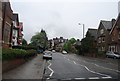

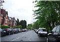
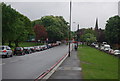
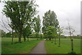
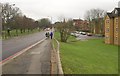
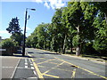
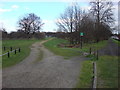
100 photos from this area
Area Information
Key information about the SW16 1QF including its size, population, and administrative classification.
- Area Type
- Postcode
- Area Size
- 8083 m²
- Population
- 2066
- Population Density
- 12096 people/km²
House Prices in SW16 1QF
56
Properties
£773,046
Average Sold Price
£125,000
Lowest Price
£2,100,000
Highest Price
Showing 56 properties
| Address | Type | Beds | Baths | Last Sale Price | Last Sale Date | |
|---|---|---|---|---|---|---|
| 35A Rydal Road, London, SW16 1QF | Flat | 2 | 1 | £561,000 | May 2025 | |
| 23 Rydal Road, London, SW16 1QF | Detached | 5 | 3 | £1,466,500 | Oct 2023 | |
| 25A Rydal Road, London, SW16 1QF | Flat | - | - | £495,000 | Sep 2023 | |
| 29A Rydal Road, London, SW16 1QF | Flat | 2 | 1 | £442,500 | Jan 2023 | |
| 5 Rydal Road, London, SW16 1QF | house | - | - | £2,100,000 | May 2021 | |
| 37A Rydal Road, London, SW16 1QF | Flat | - | - | £507,000 | Nov 2015 | |
| 33A Rydal Road, London, SW16 1QF | Flat | 2 | 1 | £374,600 | Feb 2014 | |
| 11 Rydal Road, London, SW16 1QF | house | 6 | - | £1,025,000 | Nov 2010 | |
| 17 Rydal Road, London, SW16 1QF | house | - | - | £910,000 | Jul 2009 | |
| 7 Rydal Road, London, SW16 1QF | Semi-detached | - | - | £850,000 | Aug 2006 |
Page 1 of 6
Energy Efficiency in SW16 1QF
Amenities
Schools
| Rank | School | Type | Entry gender | Ages |
|---|
Explore more schools in this area
Go to Schools tabDemographics
Household Size
Two person
most common
Accommodation Type
Flats
most common
Tenure
42
majority
Ethnic Group
White
most common
Religion
N/A
most common
Household Composition
N/A
most common
Age
47
median
Adults (30-64 years)
most common
Household Deprivation
N/A
with no deprivation
NS-SEC
45
in Lower managerial occupations
Explore more demographic insights in this area
Go to Demographics tabPlanning
Planning Constraints
- Flood RiskPremium
- Ramsar Wetland SitesPremium
- Area of Outstanding Natural BeautyPremium
- Protected Nature ReservePremium
- Protected WoodlandPremium