Area Overview for SW16 1AG
Photos of SW16 1AG

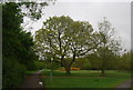
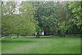
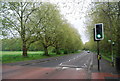
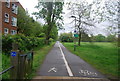


90 photos from this area
Area Information
Key information about the SW16 1AG including its size, population, and administrative classification.
- Area Type
- Postcode
- Area Size
- 2.0 hectares
- Population
- 1785
- Population Density
- 6339 people/km²
House Prices in SW16 1AG
64
Properties
£944,750
Average Sold Price
£220,000
Lowest Price
£1,695,000
Highest Price
Showing 64 properties
| Address | Type | Beds | Baths | Last Sale Price | Last Sale Date | |
|---|---|---|---|---|---|---|
| 54A Drewstead Road, London, SW16 1AG | Flat | 1 | 1 | £700,000 | Mar 2025 | |
| 84 Drewstead Road, London, SW16 1AG | Semi-detached | 4 | 1 | £1,650,000 | Nov 2022 | |
| 52 Drewstead Road, London, SW16 1AG | house | - | - | £1,695,000 | Jan 2022 | |
| 94 Drewstead Road, London, SW16 1AG | house | - | - | £1,640,000 | Apr 2021 | |
| 82 Drewstead Road, London, SW16 1AG | Semi-detached | 4 | - | £1,121,000 | Dec 2016 | |
| 80 Drewstead Road, London, SW16 1AG | Semi-detached | 5 | - | £1,300,000 | Jun 2015 | |
| 86 Drewstead Road, London, SW16 1AG | Semi-detached | 4 | - | £500,000 | Mar 2010 | |
| 46 Drewstead Road, London, SW16 1AG | Semi-detached | - | - | £865,000 | Oct 2007 | |
| 56A Drewstead Road, London, SW16 1AG | Flat | - | - | £412,500 | Jan 2007 | |
| 42 Drewstead Road, London, SW16 1AG | Detached | 6 | 3 | £740,000 | Dec 2005 |
Page 1 of 7
Energy Efficiency in SW16 1AG
Amenities
Schools
| Rank | School | Type | Entry gender | Ages |
|---|
Explore more schools in this area
Go to Schools tabDemographics
Household Size
Family (3-5 people)
most common
Accommodation Type
Houses
most common
Tenure
62
majority
Ethnic Group
White
most common
Religion
N/A
most common
Household Composition
N/A
most common
Age
47
median
Adults (30-64 years)
most common
Household Deprivation
N/A
with no deprivation
NS-SEC
46
in Lower managerial occupations
Explore more demographic insights in this area
Go to Demographics tabPlanning
Planning Constraints
- Flood RiskPremium
- Ramsar Wetland SitesPremium
- Area of Outstanding Natural BeautyPremium
- Protected Nature ReservePremium
- Protected WoodlandPremium