Area Overview for SW15 5AU
Photos of SW15 5AU
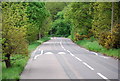
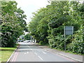
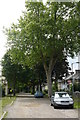
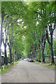
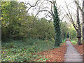
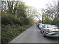
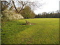
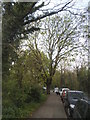
100 photos from this area
Area Information
Key information about the SW15 5AU including its size, population, and administrative classification.
- Area Type
- Postcode
- Area Size
- 7231 m²
- Population
- 1888
- Population Density
- 9094 people/km²
House Prices in SW15 5AU
35
Properties
£461,825
Average Sold Price
£84,000
Lowest Price
£830,000
Highest Price
Showing 35 properties
| Address | Type | Beds | Baths | Last Sale Price | Last Sale Date | |
|---|---|---|---|---|---|---|
| 12 Dover House Road, London, SW15 5AU | Maisonette | 1 | 1 | £425,000 | Sep 2025 | |
| 60 Dover House Road, London, SW15 5AU | Detached | 4 | 2 | £830,000 | Jul 2024 | |
| 52 Dover House Road, London, SW15 5AU | Flat | 2 | 1 | £516,000 | Jul 2023 | |
| 2B Dover House Road, London, SW15 5AU | house | - | - | £685,000 | Mar 2022 | |
| 36 Dover House Road, London, SW15 5AU | Terraced | 2 | 2 | £725,000 | Feb 2022 | |
| 32 Dover House Road, London, SW15 5AU | house | - | - | £770,000 | Feb 2021 | |
| 38 Dover House Road, London, SW15 5AU | Flat | 2 | 2 | £500,000 | Dec 2019 | |
| 66 Dover House Road, London, SW15 5AU | Terraced | 3 | 1 | £586,000 | Oct 2019 | |
| 50 Dover House Road, London, SW15 5AU | Maisonette | - | - | £395,000 | Jul 2018 | |
| 56 Dover House Road, London, SW15 5AU | Terraced | 4 | 2 | £750,000 | May 2018 |
Page 1 of 4
Energy Efficiency in SW15 5AU
Amenities
Schools
| Rank | School | Type | Entry gender | Ages |
|---|
Explore more schools in this area
Go to Schools tabDemographics
Household Size
Family (3-5 people)
most common
Accommodation Type
Houses
most common
Tenure
54
majority
Ethnic Group
White
most common
Religion
N/A
most common
Household Composition
N/A
most common
Age
47
median
Adults (30-64 years)
most common
Household Deprivation
N/A
with no deprivation
NS-SEC
46
in Lower managerial occupations
Explore more demographic insights in this area
Go to Demographics tabPlanning
Planning Constraints
- Flood RiskPremium
- Ramsar Wetland SitesPremium
- Area of Outstanding Natural BeautyPremium
- Protected Nature ReservePremium
- Protected WoodlandPremium