Area Overview for SW15 4JG
Photos of SW15 4JG
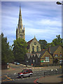
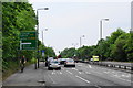
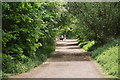
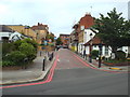
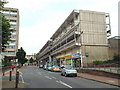
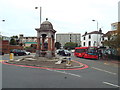
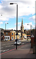
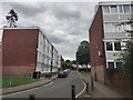
72 photos from this area
Area Information
Key information about the SW15 4JG including its size, population, and administrative classification.
- Area Type
- Postcode
- Area Size
- 4406 m²
- Population
- 1931
- Population Density
- 16401 people/km²
House Prices in SW15 4JG
24
Properties
£191,639
Average Sold Price
£59,000
Lowest Price
£375,000
Highest Price
Showing 24 properties
| Address | Type | Beds | Baths | Last Sale Price | Last Sale Date | |
|---|---|---|---|---|---|---|
| 19 Bordon Walk, London, SW15 4JG | Retail | 4 | 2 | £375,000 | Oct 2022 | |
| 11 Bordon Walk, London, SW15 4JG | Maisonette | 4 | 2 | £345,000 | May 2021 | |
| 5 Bordon Walk, London, SW15 4JG | Maisonette | - | - | £350,000 | Mar 2016 | |
| 6 Bordon Walk, London, SW15 4JG | Flat | - | - | £235,000 | May 2008 | |
| 17 Bordon Walk, London, SW15 4JG | Flat | - | - | £195,000 | Sep 2006 | |
| 14 Bordon Walk, London, SW15 4JG | Maisonette | 4 | 2 | £190,000 | Dec 2005 | |
| 12 Bordon Walk, London, SW15 4JG | Flat | 4 | 2 | £188,500 | Sep 2005 | |
| 8 Bordon Walk, London, SW15 4JG | Maisonette | 4 | 2 | £180,500 | Dec 2004 | |
| 21 Bordon Walk, London, SW15 4JG | Flat | - | - | £130,000 | Mar 2002 | |
| 13 Bordon Walk, London, SW15 4JG | Flat | - | - | £135,000 | Nov 2001 |
Page 1 of 3
Energy Efficiency in SW15 4JG
Amenities
Schools
| Rank | School | Type | Entry gender | Ages |
|---|
Explore more schools in this area
Go to Schools tabDemographics
Household Size
Family (3-5 people)
most common
Accommodation Type
Flats
most common
Tenure
14
majority
Ethnic Group
White
most common
Religion
N/A
most common
Household Composition
N/A
most common
Age
47
median
Adults (30-64 years)
most common
Household Deprivation
N/A
with no deprivation
NS-SEC
20
in Lower managerial occupations
Explore more demographic insights in this area
Go to Demographics tabPlanning
Planning Constraints
- Flood RiskPremium
- Ramsar Wetland SitesPremium
- Area of Outstanding Natural BeautyPremium
- Protected Nature ReservePremium
- Protected WoodlandPremium