Area Overview for SW15 4AH
Photos of SW15 4AH
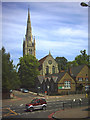
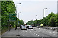
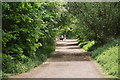
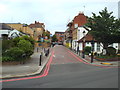
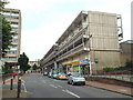
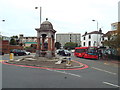
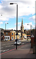
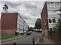
72 photos from this area
Area Information
Key information about the SW15 4AH including its size, population, and administrative classification.
- Area Type
- Postcode
- Area Size
- 4199 m²
- Population
- 1684
- Population Density
- 2141 people/km²
House Prices in SW15 4AH
26
Properties
£220,193
Average Sold Price
£53,000
Lowest Price
£433,100
Highest Price
Showing 26 properties
| Address | Type | Beds | Baths | Last Sale Price | Last Sale Date | |
|---|---|---|---|---|---|---|
| 16 Farlington Place, London, SW15 4AH | Flat | - | - | £400,000 | Jul 2025 | |
| 17 Farlington Place, London, SW15 4AH | Maisonette | 4 | 3 | £433,100 | Oct 2017 | |
| 18 Farlington Place, London, SW15 4AH | Maisonette | 3 | - | £324,950 | Jun 2015 | |
| 10 Farlington Place, London, SW15 4AH | Maisonette | 3 | 1 | £290,000 | Mar 2014 | |
| 13 Farlington Place, London, SW15 4AH | Maisonette | 3 | 1 | £180,000 | Nov 2011 | |
| 1 Farlington Place, London, SW15 4AH | Maisonette | - | - | £236,850 | Sep 2010 | |
| 20 Farlington Place, London, SW15 4AH | Flat | - | - | £240,000 | Jul 2008 | |
| 19 Farlington Place, London, SW15 4AH | Flat | - | - | £211,000 | Dec 2006 | |
| 21 Farlington Place, London, SW15 4AH | Flat | - | - | £207,500 | Oct 2006 | |
| 9 Farlington Place, London, SW15 4AH | Flat | 3 | 1 | £185,000 | Apr 2006 |
Page 1 of 3
Energy Efficiency in SW15 4AH
Amenities
Schools
| Rank | School | Type | Entry gender | Ages |
|---|
Explore more schools in this area
Go to Schools tabDemographics
Household Size
Family (3-5 people)
most common
Accommodation Type
Flats
most common
Tenure
43
majority
Ethnic Group
White
most common
Religion
N/A
most common
Household Composition
N/A
most common
Age
47
median
Adults (30-64 years)
most common
Household Deprivation
N/A
with no deprivation
NS-SEC
38
in Lower managerial occupations
Explore more demographic insights in this area
Go to Demographics tabPlanning
Planning Constraints
- Flood RiskPremium
- Ramsar Wetland SitesPremium
- Area of Outstanding Natural BeautyPremium
- Protected Nature ReservePremium
- Protected WoodlandPremium