Area Overview for SW15 3QE
Photos of SW15 3QE
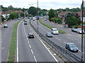
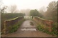
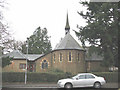
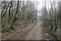
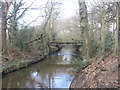
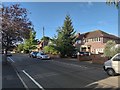
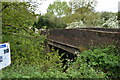
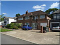
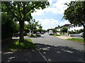
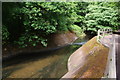

55 photos from this area
Area Information
Key information about the SW15 3QE including its size, population, and administrative classification.
- Area Type
- Postcode
- Area Size
- 1.1 hectares
- Population
- 1501
- Population Density
- 3041 people/km²
House Prices in SW15 3QE
53
Properties
£468,333
Average Sold Price
£125,000
Lowest Price
£835,000
Highest Price
Showing 53 properties
| Address | Type | Beds | Baths | Last Sale Price | Last Sale Date | |
|---|---|---|---|---|---|---|
| 139 Robin Hood Way, Kingston Vale, SW15 3QE | house | 5 | - | £800,000 | Aug 2024 | |
| 149 Robin Hood Way, Kingston Vale, SW15 3QE | Detached | 3 | 2 | £625,000 | Jan 2024 | |
| 129 Robin Hood Way, Kingston Vale, SW15 3QE | Semi-detached | 3 | 1 | £610,000 | Jan 2016 | |
| 137 Robin Hood Way, Kingston Vale, SW15 3QE | Detached | 5 | 4 | £780,000 | Jun 2015 | |
| 147 Robin Hood Way, Kingston Vale, SW15 3QE | Semi-detached | 4 | 3 | £835,000 | Apr 2014 | |
| 125 Robin Hood Way, Kingston Vale, SW15 3QE | house | - | - | £418,000 | Nov 2009 | |
| 135 Robin Hood Way, Kingston Vale, SW15 3QE | Detached | 4 | 3 | £615,000 | May 2007 | |
| 121 Robin Hood Way, Kingston Vale, SW15 3QE | Terraced | - | - | £390,000 | Sep 2006 | |
| 115 Robin Hood Way, Kingston Vale, SW15 3QE | Maisonette | - | - | £185,000 | May 2006 | |
| 145 Robin Hood Way, Kingston Vale, SW15 3QE | Detached | - | - | £490,000 | Nov 2005 |
Page 1 of 6
Energy Efficiency in SW15 3QE
Amenities
Schools
| Rank | School | Type | Entry gender | Ages |
|---|
Explore more schools in this area
Go to Schools tabDemographics
Household Size
Family (3-5 people)
most common
Accommodation Type
Houses
most common
Tenure
65
majority
Ethnic Group
White
most common
Religion
N/A
most common
Household Composition
N/A
most common
Age
47
median
Adults (30-64 years)
most common
Household Deprivation
N/A
with no deprivation
NS-SEC
40
in Lower managerial occupations
Explore more demographic insights in this area
Go to Demographics tabPlanning
Planning Constraints
- Flood RiskPremium
- Ramsar Wetland SitesPremium
- Area of Outstanding Natural BeautyPremium
- Protected Nature ReservePremium
- Protected WoodlandPremium