Area Overview for SW14 8NG
Photos of SW14 8NG
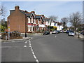
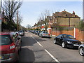
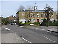

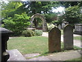
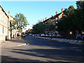
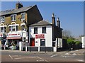
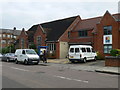
100 photos from this area
Area Information
Key information about the SW14 8NG including its size, population, and administrative classification.
- Area Type
- Postcode
- Area Size
- 1.0 hectares
- Population
- 1890
- Population Density
- 13938 people/km²
House Prices in SW14 8NG
31
Properties
£840,382
Average Sold Price
£316,700
Lowest Price
£1,200,000
Highest Price
Showing 31 properties
| Address | Type | Beds | Baths | Last Sale Price | Last Sale Date | |
|---|---|---|---|---|---|---|
| 198 South Worple Way, East Sheen, London, SW14 8NG | Detached | 3 | 2 | £1,005,000 | Feb 2025 | |
| 200 South Worple Way, East Sheen, London, SW14 8NG | Flat | 1 | 1 | £1,000,000 | Jan 2025 | |
| 199 South Worple Way, East Sheen, London, SW14 8NG | Detached | 3 | 2 | £1,000,000 | Dec 2024 | |
| 197 South Worple Way, East Sheen, London, SW14 8NG | Detached | 3 | 2 | £1,007,500 | Dec 2024 | |
| 91 South Worple Way, East Sheen, London, SW14 8NG | Terraced | 5 | 3 | £1,200,000 | Aug 2024 | |
| 87 South Worple Way, East Sheen, London, SW14 8NG | Retail | 4 | 2 | £1,160,000 | Sep 2022 | |
| 78 South Worple Way, East Sheen, London, SW14 8NG | Terraced | 5 | 2 | £1,005,000 | Jun 2018 | |
| Bridge Cottage, South Worple Way, East Sheen, London, SW14 8NG | house | 2 | - | £600,000 | Jan 2014 | |
| 82 South Worple Way, East Sheen, London, SW14 8NG | house | - | - | £460,000 | Nov 2006 | |
| 90 South Worple Way, East Sheen, London, SW14 8NG | Terraced | 4 | 2 | £490,000 | Aug 2006 |
Page 1 of 4
Energy Efficiency in SW14 8NG
Amenities
Schools
| Rank | School | Type | Entry gender | Ages |
|---|
Explore more schools in this area
Go to Schools tabDemographics
Household Size
Family (3-5 people)
most common
Accommodation Type
Houses
most common
Tenure
70
majority
Ethnic Group
White
most common
Religion
N/A
most common
Household Composition
N/A
most common
Age
47
median
Adults (30-64 years)
most common
Household Deprivation
N/A
with no deprivation
NS-SEC
63
in Lower managerial occupations
Explore more demographic insights in this area
Go to Demographics tabPlanning
Planning Constraints
- Flood RiskPremium
- Ramsar Wetland SitesPremium
- Area of Outstanding Natural BeautyPremium
- Protected Nature ReservePremium
- Protected WoodlandPremium