Area Overview for SW14 8HQ
Photos of SW14 8HQ

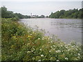
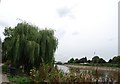
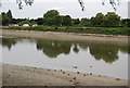
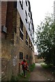
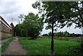
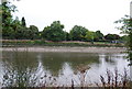
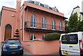
100 photos from this area
Area Information
Key information about the SW14 8HQ including its size, population, and administrative classification.
- Area Type
- Postcode
- Area Size
- 2.0 hectares
- Population
- 1691
- Population Density
- 13895 people/km²
House Prices in SW14 8HQ
24
Properties
£1,046,833
Average Sold Price
£345,000
Lowest Price
£2,200,000
Highest Price
Showing 24 properties
| Address | Type | Beds | Baths | Last Sale Price | Last Sale Date | |
|---|---|---|---|---|---|---|
| 109 Mortlake High Street, Mortlake, London, SW14 8HQ | Terraced | 2 | 2 | £610,000 | Jun 2021 | |
| 103 Mortlake High Street, Mortlake, London, SW14 8HQ | Terraced | 3 | 2 | £1,960,000 | Apr 2021 | |
| 113 Mortlake High Street, Mortlake, London, SW14 8HQ | house | 1 | 2 | £616,000 | Mar 2018 | |
| 111 Mortlake High Street, Mortlake, London, SW14 8HQ | house | - | - | £550,000 | Feb 2017 | |
| 105 Mortlake High Street, Mortlake, London, SW14 8HQ | house | - | - | £2,200,000 | Mar 2008 | |
| 101 Mortlake High Street, Mortlake, London, SW14 8HQ | Flat | - | - | £345,000 | Jan 1999 | |
| 119A Mortlake High Street, Mortlake, London, SW14 8HQ | Flat | 3 | 3 | - | - | |
| Flat 2, 119 Mortlake High Street, Mortlake, London, SW14 8HQ | Flat | 2 | 1 | - | - | |
| Flat 8, Telstar Court, 107 Mortlake High Street, Mortlake, London, SW14 8HQ | Flat | 3 | 2 | - | - | |
| Flat 1, 119 Mortlake High Street, Mortlake, London, SW14 8HQ | Flat | 2 | - | - | - |
Page 1 of 3
Energy Efficiency in SW14 8HQ
Amenities
Schools
| Rank | School | Type | Entry gender | Ages |
|---|
Explore more schools in this area
Go to Schools tabDemographics
Household Size
Family (3-5 people)
most common
Accommodation Type
Flats
most common
Tenure
52
majority
Ethnic Group
White
most common
Religion
N/A
most common
Household Composition
N/A
most common
Age
47
median
Adults (30-64 years)
most common
Household Deprivation
N/A
with no deprivation
NS-SEC
60
in Lower managerial occupations
Explore more demographic insights in this area
Go to Demographics tabPlanning
Planning Constraints
- Flood RiskPremium
- Ramsar Wetland SitesPremium
- Area of Outstanding Natural BeautyPremium
- Protected Nature ReservePremium
- Protected WoodlandPremium