Area Overview for SW14 7HX
Photos of SW14 7HX

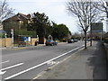

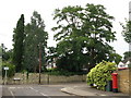
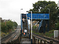

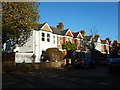

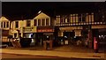

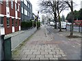
97 photos from this area
Area Information
Key information about the SW14 7HX including its size, population, and administrative classification.
- Area Type
- Postcode
- Area Size
- 9441 m²
- Population
- 1445
- Population Density
- 10555 people/km²
House Prices in SW14 7HX
38
Properties
£509,837
Average Sold Price
£94,000
Lowest Price
£985,000
Highest Price
Showing 38 properties
| Address | Type | Beds | Baths | Last Sale Price | Last Sale Date | |
|---|---|---|---|---|---|---|
| 109 Lower Richmond Road, Mortlake, London, SW14 7HX | house | - | - | £985,000 | Sep 2024 | |
| 163 Lower Richmond Road, Mortlake, London, SW14 7HX | Flat | 3 | 1 | £565,000 | Mar 2023 | |
| 141 Lower Richmond Road, Mortlake, London, SW14 7HX | house | - | - | £860,000 | Oct 2021 | |
| 161 Lower Richmond Road, Mortlake, London, SW14 7HX | Maisonette | 3 | 1 | £540,000 | Apr 2021 | |
| 157 Lower Richmond Road, Mortlake, London, SW14 7HX | Flat | 2 | 1 | £565,000 | Feb 2021 | |
| 165 Lower Richmond Road, Mortlake, London, SW14 7HX | Flat | 3 | 2 | £595,000 | Jan 2021 | |
| 151 Lower Richmond Road, Mortlake, London, SW14 7HX | Maisonette | 2 | 1 | £560,000 | Nov 2020 | |
| 153 Lower Richmond Road, Mortlake, London, SW14 7HX | Flat | 3 | 2 | £525,000 | Oct 2019 | |
| 107 Lower Richmond Road, Mortlake, London, SW14 7HX | Terraced | 4 | 2 | £925,000 | Jul 2018 | |
| 169 Lower Richmond Road, Mortlake, London, SW14 7HX | Flat | - | - | £225,000 | Oct 2016 |
Page 1 of 4
Energy Efficiency in SW14 7HX
Amenities
Schools
| Rank | School | Type | Entry gender | Ages |
|---|
Explore more schools in this area
Go to Schools tabDemographics
Household Size
Family (3-5 people)
most common
Accommodation Type
Houses
most common
Tenure
57
majority
Ethnic Group
White
most common
Religion
N/A
most common
Household Composition
N/A
most common
Age
47
median
Adults (30-64 years)
most common
Household Deprivation
N/A
with no deprivation
NS-SEC
50
in Lower managerial occupations
Explore more demographic insights in this area
Go to Demographics tabPlanning
Planning Constraints
- Flood RiskPremium
- Ramsar Wetland SitesPremium
- Area of Outstanding Natural BeautyPremium
- Protected Nature ReservePremium
- Protected WoodlandPremium