Area Overview for SW14 7AT
Photos of SW14 7AT
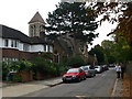
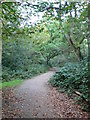
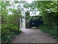
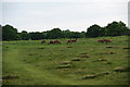
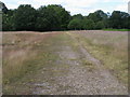


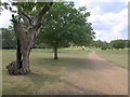
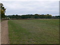
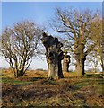
63 photos from this area
Area Information
Key information about the SW14 7AT including its size, population, and administrative classification.
- Area Type
- Postcode
- Area Size
- 1.8 hectares
- Population
- 1727
- Population Density
- 2164 people/km²
House Prices in SW14 7AT
20
Properties
£2,312,814
Average Sold Price
£722,251
Lowest Price
£7,650,000
Highest Price
Showing 20 properties
| Address | Type | Beds | Baths | Last Sale Price | Last Sale Date | |
|---|---|---|---|---|---|---|
| 77 Christchurch Road, East Sheen, London, SW14 7AT | house | - | - | £1,700,000 | Apr 2021 | |
| 71 Christchurch Road, East Sheen, London, SW14 7AT | house | - | - | £2,600,000 | Jan 2021 | |
| 105 Christchurch Road, East Sheen, London, SW14 7AT | house | - | - | £7,650,000 | Sep 2019 | |
| 79 Christchurch Road, East Sheen, London, SW14 7AT | Detached | 7 | 4 | £3,100,000 | Sep 2019 | |
| 87 Christchurch Road, East Sheen, London, SW14 7AT | house | 4 | 2 | £1,800,000 | Dec 2018 | |
| 73 Christchurch Road, East Sheen, London, SW14 7AT | Detached | 5 | 1 | £2,300,000 | Sep 2016 | |
| The Badgers, 75 Christchurch Road, East Sheen, London, SW14 7AT | Detached | 5 | 3 | £2,300,000 | Aug 2015 | |
| 107 Christchurch Road, East Sheen, London, SW14 7AT | Semi-detached | 7 | 4 | £3,125,000 | Dec 2014 | |
| 81 Christchurch Road, East Sheen, London, SW14 7AT | Detached | 3 | 2 | £800,000 | Jun 2010 | |
| 103 Christchurch Road, East Sheen, London, SW14 7AT | Semi-detached | - | - | £722,251 | Jul 2006 |
Page 1 of 2
Energy Efficiency in SW14 7AT
Amenities
Schools
| Rank | School | Type | Entry gender | Ages |
|---|
Explore more schools in this area
Go to Schools tabDemographics
Household Size
Family (3-5 people)
most common
Accommodation Type
Houses
most common
Tenure
85
majority
Ethnic Group
White
most common
Religion
N/A
most common
Household Composition
N/A
most common
Age
47
median
Adults (30-64 years)
most common
Household Deprivation
N/A
with no deprivation
NS-SEC
62
in Lower managerial occupations
Explore more demographic insights in this area
Go to Demographics tabPlanning
Planning Constraints
- Flood RiskPremium
- Ramsar Wetland SitesPremium
- Area of Outstanding Natural BeautyPremium
- Protected Nature ReservePremium
- Protected WoodlandPremium