Area Overview for SW13 9LY
Photos of SW13 9LY
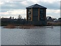
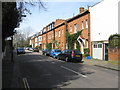
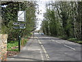
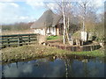

100 photos from this area
Area Information
Key information about the SW13 9LY including its size, population, and administrative classification.
- Area Type
- Postcode
- Area Size
- 1.5 hectares
- Population
- 1425
- Population Density
- 3390 people/km²
House Prices in SW13 9LY
26
Properties
£1,473,983
Average Sold Price
£325,000
Lowest Price
£3,060,000
Highest Price
Showing 26 properties
| Address | Type | Beds | Baths | Last Sale Price | Last Sale Date | |
|---|---|---|---|---|---|---|
| 11 Cumberland Road, Barnes, London, SW13 9LY | Semi-detached | 3 | 1 | £3,060,000 | Jan 2022 | |
| 6 Cumberland Road, Barnes, London, SW13 9LY | house | - | - | £2,314,000 | Dec 2019 | |
| 13 Cumberland Road, Barnes, London, SW13 9LY | Semi-detached | 3 | 1 | £1,630,000 | May 2019 | |
| 4 Cumberland Road, Barnes, London, SW13 9LY | house | 6 | 3 | £2,950,000 | Mar 2016 | |
| 3 Cumberland Road, Barnes, London, SW13 9LY | Semi-detached | 4 | - | £1,400,000 | May 2013 | |
| 20 Cumberland Road, Barnes, London, SW13 9LY | house | 7 | - | £1,875,000 | Sep 2012 | |
| 17 Cumberland Road, Barnes, London, SW13 9LY | Semi-detached | 4 | - | £1,550,000 | Jan 2011 | |
| 10 Cumberland Road, Barnes, London, SW13 9LY | house | - | - | £2,087,000 | Jul 2009 | |
| 22 Cumberland Road, Barnes, London, SW13 9LY | Semi-detached | - | - | £1,425,000 | Dec 2006 | |
| 21 Cumberland Road, Barnes, London, SW13 9LY | Semi-detached | - | - | £1,028,750 | Sep 2006 |
Page 1 of 3
Energy Efficiency in SW13 9LY
Amenities
Schools
| Rank | School | Type | Entry gender | Ages |
|---|
Explore more schools in this area
Go to Schools tabDemographics
Household Size
Family (3-5 people)
most common
Accommodation Type
Houses
most common
Tenure
82
majority
Ethnic Group
White
most common
Religion
N/A
most common
Household Composition
N/A
most common
Age
47
median
Adults (30-64 years)
most common
Household Deprivation
N/A
with no deprivation
NS-SEC
61
in Lower managerial occupations
Explore more demographic insights in this area
Go to Demographics tabPlanning
Planning Constraints
- Flood RiskPremium
- Ramsar Wetland SitesPremium
- Area of Outstanding Natural BeautyPremium
- Protected Nature ReservePremium
- Protected WoodlandPremium