Area Overview for SW13 9AA
Photos of SW13 9AA
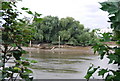
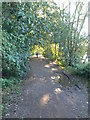
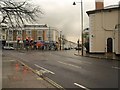
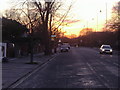
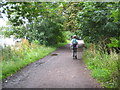
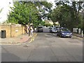
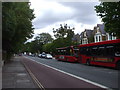
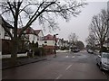
100 photos from this area
Area Information
Key information about the SW13 9AA including its size, population, and administrative classification.
- Area Type
- Postcode
- Area Size
- 1.1 hectares
- Population
- 1503
- Population Density
- 5851 people/km²
House Prices in SW13 9AA
29
Properties
£671,264
Average Sold Price
£165,000
Lowest Price
£965,900
Highest Price
Showing 29 properties
| Address | Type | Beds | Baths | Last Sale Price | Last Sale Date | |
|---|---|---|---|---|---|---|
| 33 Barnes Avenue, Barnes, London, SW13 9AA | Terraced | 3 | 1 | £920,000 | Apr 2024 | |
| 21 Barnes Avenue, Barnes, London, SW13 9AA | Terraced | 4 | 2 | £935,000 | Jun 2022 | |
| 57 Barnes Avenue, Barnes, London, SW13 9AA | house | 4 | - | £878,000 | Nov 2021 | |
| 3 Barnes Avenue, Barnes, London, SW13 9AA | Terraced | 3 | 2 | £965,900 | Sep 2021 | |
| 1 Barnes Avenue, Barnes, London, SW13 9AA | Terraced | 3 | 2 | £650,000 | Dec 2020 | |
| 43 Barnes Avenue, Barnes, London, SW13 9AA | house | - | - | £861,000 | Mar 2020 | |
| 49 Barnes Avenue, Barnes, London, SW13 9AA | Terraced | 3 | 2 | £655,000 | Jan 2014 | |
| 17 Barnes Avenue, Barnes, London, SW13 9AA | house | - | - | £499,000 | Jun 2012 | |
| 19 Barnes Avenue, Barnes, London, SW13 9AA | house | 2 | - | £395,000 | Jul 2011 | |
| 25 Barnes Avenue, Barnes, London, SW13 9AA | Terraced | 5 | 3 | £460,000 | Mar 2008 |
Page 1 of 3
Energy Efficiency in SW13 9AA
Amenities
Schools
| Rank | School | Type | Entry gender | Ages |
|---|
Explore more schools in this area
Go to Schools tabDemographics
Household Size
Family (3-5 people)
most common
Accommodation Type
Houses
most common
Tenure
53
majority
Ethnic Group
White
most common
Religion
N/A
most common
Household Composition
N/A
most common
Age
47
median
Adults (30-64 years)
most common
Household Deprivation
N/A
with no deprivation
NS-SEC
49
in Lower managerial occupations
Explore more demographic insights in this area
Go to Demographics tabPlanning
Planning Constraints
- Flood RiskPremium
- Ramsar Wetland SitesPremium
- Area of Outstanding Natural BeautyPremium
- Protected Nature ReservePremium
- Protected WoodlandPremium