Area Overview for SW13 8ET
Photos of SW13 8ET
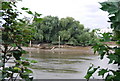
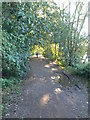
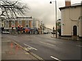

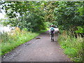
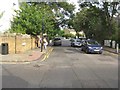
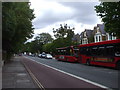
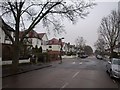
100 photos from this area
Area Information
Key information about the SW13 8ET including its size, population, and administrative classification.
- Area Type
- Postcode
- Area Size
- 5923 m²
- Population
- 1387
- Population Density
- 3532 people/km²
House Prices in SW13 8ET
18
Properties
£906,528
Average Sold Price
£275,000
Lowest Price
£1,850,000
Highest Price
Showing 18 properties
| Address | Type | Beds | Baths | Last Sale Price | Last Sale Date | |
|---|---|---|---|---|---|---|
| 41 Trinity Church Road, Barnes, London, SW13 8ET | Terraced | 4 | 3 | £1,335,000 | Dec 2020 | |
| 21 Trinity Church Road, Barnes, London, SW13 8ET | Detached | 4 | 3 | £1,850,000 | Oct 2020 | |
| 17 Trinity Church Road, Barnes, London, SW13 8ET | Detached | 4 | 4 | £1,680,000 | Jun 2014 | |
| 13 Trinity Church Road, Barnes, London, SW13 8ET | Terraced | 3 | 3 | £1,050,000 | Apr 2009 | |
| 11 Trinity Church Road, Barnes, London, SW13 8ET | Terraced | 4 | - | £1,200,000 | Mar 2008 | |
| 19 Trinity Church Road, Barnes, London, SW13 8ET | Terraced | - | - | £1,210,000 | Oct 2007 | |
| 29 Trinity Church Road, Barnes, London, SW13 8ET | Terraced | 4 | 4 | £790,000 | Jan 2007 | |
| 37 Trinity Church Road, Barnes, London, SW13 8ET | Terraced | 4 | 4 | £900,000 | Aug 2006 | |
| 35 Trinity Church Road, Barnes, London, SW13 8ET | Terraced | - | - | £870,000 | Apr 2006 | |
| 43 Trinity Church Road, Barnes, London, SW13 8ET | Terraced | 4 | 3 | £830,000 | Jun 2004 |
Page 1 of 2
Energy Efficiency in SW13 8ET
Amenities
Schools
| Rank | School | Type | Entry gender | Ages |
|---|
Explore more schools in this area
Go to Schools tabDemographics
Household Size
Family (3-5 people)
most common
Accommodation Type
Flats
most common
Tenure
55
majority
Ethnic Group
White
most common
Religion
N/A
most common
Household Composition
N/A
most common
Age
47
median
Adults (30-64 years)
most common
Household Deprivation
N/A
with no deprivation
NS-SEC
62
in Lower managerial occupations
Explore more demographic insights in this area
Go to Demographics tabPlanning
Planning Constraints
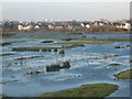
- Flood RiskPremium
- Ramsar Wetland SitesPremium
- Area of Outstanding Natural BeautyPremium
- Protected Nature ReservePremium
- Protected WoodlandPremium