Area Overview for SW13 0BN
Photos of SW13 0BN
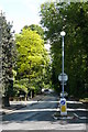
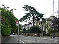
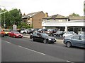
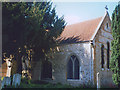
100 photos from this area
Area Information
Key information about the SW13 0BN including its size, population, and administrative classification.
- Area Type
- Postcode
- Area Size
- 5.4 hectares
- Population
- 1434
- Population Density
- 4761 people/km²
House Prices in SW13 0BN
6
Properties
£1,955,000
Average Sold Price
£410,000
Lowest Price
£3,500,000
Highest Price
Showing 6 properties
| Address | Type | Beds | Baths | Last Sale Price | Last Sale Date | |
|---|---|---|---|---|---|---|
| 30 Ranelagh Avenue, Barnes, London, SW13 0BN | Flat | - | - | £3,500,000 | Oct 2015 | |
| Ashleigh, 29 Ranelagh Avenue, Barnes, London, SW13 0BN | house | - | - | £410,000 | Jan 1997 | |
| 29A Ranelagh Avenue, Barnes, London, SW13 0BN | Detached | 4 | 4 | - | - | |
| Shenehom Housing Association, Shenehom Housing Association Ltd, 31-32 Ranelagh Avenue, Barnes, London, SW13 0BN | hospital_care_home | - | - | - | - | |
| 29B Ranelagh Avenue, Barnes, London, SW13 0BN | Flat | 1 | - | - | - | |
| 31 Ranelagh Avenue, Barnes, London, SW13 0BN | Flat | - | - | - | - |
Energy Efficiency in SW13 0BN
Amenities
Schools
| Rank | School | Type | Entry gender | Ages |
|---|
Explore more schools in this area
Go to Schools tabDemographics
Household Size
Family (3-5 people)
most common
Accommodation Type
Houses
most common
Tenure
64
majority
Ethnic Group
White
most common
Religion
N/A
most common
Household Composition
N/A
most common
Age
47
median
Adults (30-64 years)
most common
Household Deprivation
N/A
with no deprivation
NS-SEC
55
in Lower managerial occupations
Explore more demographic insights in this area
Go to Demographics tabPlanning
Planning Constraints
- Flood RiskPremium
- Ramsar Wetland SitesPremium
- Area of Outstanding Natural BeautyPremium
- Protected Nature ReservePremium
- Protected WoodlandPremium