Area Overview for SW12 9LA
Photos of SW12 9LA
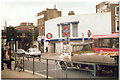
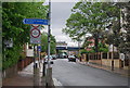
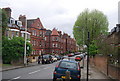
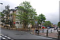
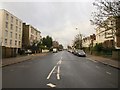
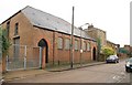
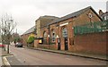

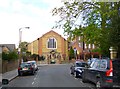
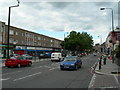
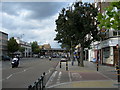
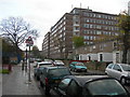
100 photos from this area
Area Information
Key information about the SW12 9LA including its size, population, and administrative classification.
- Area Type
- Postcode
- Area Size
- 6094 m²
- Population
- 1812
- Population Density
- 9428 people/km²
House Prices in SW12 9LA
48
Properties
£581,521
Average Sold Price
£250,000
Lowest Price
£1,275,000
Highest Price
Showing 48 properties
| Address | Type | Beds | Baths | Last Sale Price | Last Sale Date | |
|---|---|---|---|---|---|---|
| 48 Lynn Road, London, SW12 9LA | Flat | 2 | 1 | £640,000 | Nov 2024 | |
| 4 Lynn Road, London, SW12 9LA | Terraced | 4 | 1 | £1,000,000 | Feb 2023 | |
| 46 Lynn Road, London, SW12 9LA | Flat | 4 | 2 | £454,250 | Aug 2021 | |
| 16 Lynn Road, London, SW12 9LA | Terraced | 4 | 2 | £1,275,000 | Aug 2019 | |
| 38 Lynn Road, London, SW12 9LA | Flat | 3 | 1 | £672,000 | Apr 2014 | |
| 8 Lynn Road, London, SW12 9LA | Terraced | - | - | £830,000 | Aug 2012 | |
| 42 Lynn Road, London, SW12 9LA | Flat | 2 | 1 | £407,000 | Jun 2010 | |
| 34 Lynn Road, London, SW12 9LA | Flat | 2 | 1 | £360,000 | Oct 2007 | |
| 50 Lynn Road, London, SW12 9LA | Flat | - | - | £400,000 | Oct 2007 | |
| 40 Lynn Road, London, SW12 9LA | Flat | - | - | £250,000 | Jan 2005 |
Page 1 of 5
Energy Efficiency in SW12 9LA
Amenities
Schools
| Rank | School | Type | Entry gender | Ages |
|---|
Explore more schools in this area
Go to Schools tabDemographics
Household Size
Two person
most common
Accommodation Type
Flats
most common
Tenure
33
majority
Ethnic Group
White
most common
Religion
N/A
most common
Household Composition
N/A
most common
Age
47
median
Adults (30-64 years)
most common
Household Deprivation
N/A
with no deprivation
NS-SEC
63
in Lower managerial occupations
Explore more demographic insights in this area
Go to Demographics tabPlanning
Planning Constraints
- Flood RiskPremium
- Ramsar Wetland SitesPremium
- Area of Outstanding Natural BeautyPremium
- Protected Nature ReservePremium
- Protected WoodlandPremium