Area Overview for SW12 8LS
Photos of SW12 8LS
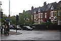
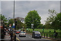
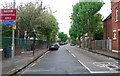
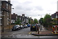
100 photos from this area
Area Information
Key information about the SW12 8LS including its size, population, and administrative classification.
- Area Type
- Postcode
- Area Size
- 5232 m²
- Population
- 1572
- Population Density
- 11918 people/km²
House Prices in SW12 8LS
28
Properties
£999,274
Average Sold Price
£320,000
Lowest Price
£1,760,100
Highest Price
Showing 28 properties
| Address | Type | Beds | Baths | Last Sale Price | Last Sale Date | |
|---|---|---|---|---|---|---|
| 59 Calbourne Road, London, SW12 8LS | Terraced | 5 | 2 | £1,435,000 | Dec 2023 | |
| 83 Calbourne Road, London, SW12 8LS | Terraced | 4 | 1 | £1,693,750 | Dec 2022 | |
| 75 Calbourne Road, London, SW12 8LS | house | - | - | £1,760,100 | Feb 2022 | |
| 95 Calbourne Road, London, SW12 8LS | Terraced | 4 | 3 | £1,670,000 | Jan 2022 | |
| 97 Calbourne Road, London, SW12 8LS | Terraced | 5 | 3 | £1,185,000 | Jul 2018 | |
| 81 Calbourne Road, London, SW12 8LS | house | - | - | £1,501,000 | Jul 2017 | |
| 87 Calbourne Road, London, SW12 8LS | Terraced | 4 | 2 | £1,310,000 | May 2016 | |
| 105 Calbourne Road, London, SW12 8LS | Terraced | 4 | 2 | £1,300,000 | Jan 2016 | |
| 67 Calbourne Road, London, SW12 8LS | Terraced | 4 | 2 | £1,223,000 | Dec 2014 | |
| 111 Calbourne Road, London, SW12 8LS | Terraced | 4 | - | £1,365,000 | Jul 2014 |
Page 1 of 3
Energy Efficiency in SW12 8LS
Amenities
Schools
| Rank | School | Type | Entry gender | Ages |
|---|
Explore more schools in this area
Go to Schools tabDemographics
Household Size
Family (3-5 people)
most common
Accommodation Type
Houses
most common
Tenure
66
majority
Ethnic Group
White
most common
Religion
N/A
most common
Household Composition
N/A
most common
Age
47
median
Adults (30-64 years)
most common
Household Deprivation
N/A
with no deprivation
NS-SEC
66
in Lower managerial occupations
Explore more demographic insights in this area
Go to Demographics tabPlanning
Planning Constraints
- Flood RiskPremium
- Ramsar Wetland SitesPremium
- Area of Outstanding Natural BeautyPremium
- Protected Nature ReservePremium
- Protected WoodlandPremium