Area Overview for SW12 8EN
Photos of SW12 8EN

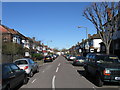
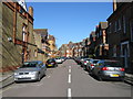
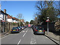
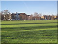
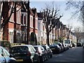
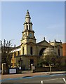
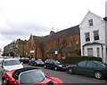
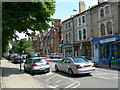
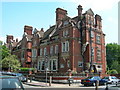
100 photos from this area
Area Information
Key information about the SW12 8EN including its size, population, and administrative classification.
- Area Type
- Postcode
- Area Size
- 1.6 hectares
- Population
- 1812
- Population Density
- 9428 people/km²
House Prices in SW12 8EN
76
Properties
£1,308,000
Average Sold Price
£142,000
Lowest Price
£2,870,001
Highest Price
Showing 76 properties
| Address | Type | Beds | Baths | Last Sale Price | Last Sale Date | |
|---|---|---|---|---|---|---|
| 17 Malwood Road, London, SW12 8EN | Detached | 7 | 4 | £2,360,000 | Aug 2024 | |
| 26 Malwood Road, London, SW12 8EN | Semi-detached | 6 | 3 | £1,920,000 | Nov 2022 | |
| 1, Foyer Apartments, 2 Malwood Road, London, SW12 8EN | Maisonette | 2 | - | £540,000 | Nov 2022 | |
| 13 Malwood Road, London, SW12 8EN | Terraced | 5 | 2 | £1,835,000 | Dec 2019 | |
| 32 Malwood Road, London, SW12 8EN | Semi-detached | 5 | 3 | £1,810,000 | Jul 2017 | |
| 19 Malwood Road, London, SW12 8EN | Terraced | 7 | - | £2,250,000 | Feb 2017 | |
| 34 Malwood Road, London, SW12 8EN | house | - | - | £1,725,000 | Dec 2015 | |
| 22 Malwood Road, London, SW12 8EN | Semi-detached | 5 | 4 | £2,870,001 | Apr 2015 | |
| 8 Malwood Road, London, SW12 8EN | Flat | - | - | £385,000 | Dec 2013 | |
| 33 Malwood Road, London, SW12 8EN | house | 6 | - | £2,180,000 | Jul 2011 |
Page 1 of 8
Energy Efficiency in SW12 8EN
Amenities
Schools
| Rank | School | Type | Entry gender | Ages |
|---|
Explore more schools in this area
Go to Schools tabDemographics
Household Size
Two person
most common
Accommodation Type
Flats
most common
Tenure
33
majority
Ethnic Group
White
most common
Religion
N/A
most common
Household Composition
N/A
most common
Age
47
median
Adults (30-64 years)
most common
Household Deprivation
N/A
with no deprivation
NS-SEC
63
in Lower managerial occupations
Explore more demographic insights in this area
Go to Demographics tabPlanning
Planning Constraints
- Flood RiskPremium
- Ramsar Wetland SitesPremium
- Area of Outstanding Natural BeautyPremium
- Protected Nature ReservePremium
- Protected WoodlandPremium