Area Overview for SW12 0DP
Photos of SW12 0DP
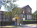
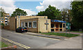
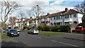
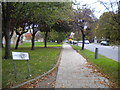
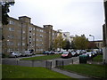
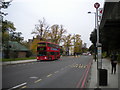
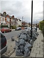
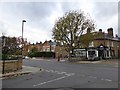
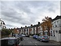
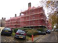
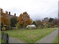
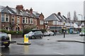
73 photos from this area
Area Information
Key information about the SW12 0DP including its size, population, and administrative classification.
- Area Type
- Postcode
- Area Size
- 7978 m²
- Population
- 1317
- Population Density
- 11067 people/km²
House Prices in SW12 0DP
38
Properties
£759,694
Average Sold Price
£227,000
Lowest Price
£1,400,000
Highest Price
Showing 38 properties
| Address | Type | Beds | Baths | Last Sale Price | Last Sale Date | |
|---|---|---|---|---|---|---|
| 9 Honeybrook Road, London, SW12 0DP | house | 1 | - | £1,070,000 | Aug 2022 | |
| 19 Honeybrook Road, London, SW12 0DP | Terraced | 3 | 2 | £1,400,000 | Jul 2022 | |
| 15 Honeybrook Road, London, SW12 0DP | house | 5 | 3 | £1,120,000 | Dec 2019 | |
| 29 Honeybrook Road, London, SW12 0DP | Terraced | 4 | 2 | £1,275,000 | Aug 2019 | |
| 25 Honeybrook Road, London, SW12 0DP | Terraced | - | - | £525,250 | Sep 2006 | |
| 31 Honeybrook Road, London, SW12 0DP | Terraced | - | - | £435,000 | Nov 2005 | |
| 23 Honeybrook Road, London, SW12 0DP | Terraced | - | - | £380,000 | Jul 2004 | |
| 43 Honeybrook Road, London, SW12 0DP | Terraced | - | - | £405,000 | Apr 2004 | |
| 11 Honeybrook Road, London, SW12 0DP | Terraced | 5 | 3 | £227,000 | Jul 1999 | |
| Ground Floor Flat, 27 Honeybrook Road, London, SW12 0DP | Flat | 2 | 1 | - | - |
Page 1 of 4
Energy Efficiency in SW12 0DP
Amenities
Schools
| Rank | School | Type | Entry gender | Ages |
|---|
Explore more schools in this area
Go to Schools tabDemographics
Household Size
Two person
most common
Accommodation Type
Flats
most common
Tenure
48
majority
Ethnic Group
White
most common
Religion
N/A
most common
Household Composition
N/A
most common
Age
47
median
Adults (30-64 years)
most common
Household Deprivation
N/A
with no deprivation
NS-SEC
61
in Lower managerial occupations
Explore more demographic insights in this area
Go to Demographics tabPlanning
Planning Constraints
- Flood RiskPremium
- Ramsar Wetland SitesPremium
- Area of Outstanding Natural BeautyPremium
- Protected Nature ReservePremium
- Protected WoodlandPremium