Area Overview for SW11 6SW
Photos of SW11 6SW
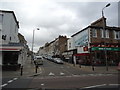
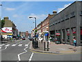
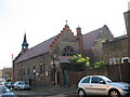
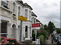
100 photos from this area
Area Information
Key information about the SW11 6SW including its size, population, and administrative classification.
- Area Type
- Postcode
- Area Size
- 3008 m²
- Population
- 1845
- Population Density
- 8149 people/km²
House Prices in SW11 6SW
18
Properties
£646,338
Average Sold Price
£215,000
Lowest Price
£930,000
Highest Price
Showing 18 properties
| Address | Type | Beds | Baths | Last Sale Price | Last Sale Date | |
|---|---|---|---|---|---|---|
| 1 Darley Road, London, SW11 6SW | Terraced | 2 | 1 | £765,000 | Aug 2023 | |
| 9 Darley Road, London, SW11 6SW | house | - | - | £675,000 | Mar 2023 | |
| 17 Darley Road, London, SW11 6SW | house | 3 | 2 | £785,000 | Jun 2022 | |
| 25 Darley Road, London, SW11 6SW | house | 3 | 1 | £720,000 | Jun 2022 | |
| 21 Darley Road, London, SW11 6SW | Terraced | 3 | 2 | £793,000 | Apr 2022 | |
| 33 Darley Road, London, SW11 6SW | Terraced | 3 | 2 | £930,000 | Jul 2021 | |
| 3 Darley Road, London, SW11 6SW | Terraced | 3 | 2 | £519,040 | Feb 2014 | |
| 7 Darley Road, London, SW11 6SW | Terraced | - | - | £415,000 | May 2007 | |
| 31 Darley Road, London, SW11 6SW | house | - | - | £215,000 | Jun 2001 | |
| 23A Darley Road, London, SW11 6SW | Detached | 4 | 2 | - | - |
Page 1 of 2
Energy Efficiency in SW11 6SW
Amenities
Schools
| Rank | School | Type | Entry gender | Ages |
|---|
Explore more schools in this area
Go to Schools tabDemographics
Household Size
Family (3-5 people)
most common
Accommodation Type
Flats
most common
Tenure
54
majority
Ethnic Group
White
most common
Religion
N/A
most common
Household Composition
N/A
most common
Age
47
median
Adults (30-64 years)
most common
Household Deprivation
N/A
with no deprivation
NS-SEC
65
in Lower managerial occupations
Explore more demographic insights in this area
Go to Demographics tabPlanning
Planning Constraints
- Flood RiskPremium
- Ramsar Wetland SitesPremium
- Area of Outstanding Natural BeautyPremium
- Protected Nature ReservePremium
- Protected WoodlandPremium