Area Overview for SW11 6RW
Photos of SW11 6RW
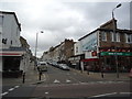
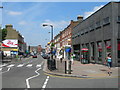
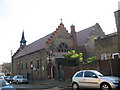
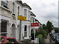
100 photos from this area
Area Information
Key information about the SW11 6RW including its size, population, and administrative classification.
- Area Type
- Postcode
- Area Size
- 7703 m²
- Population
- 1646
- Population Density
- 16526 people/km²
House Prices in SW11 6RW
48
Properties
£1,047,634
Average Sold Price
£168,000
Lowest Price
£2,679,510
Highest Price
Showing 48 properties
| Address | Type | Beds | Baths | Last Sale Price | Last Sale Date | |
|---|---|---|---|---|---|---|
| 131 Leathwaite Road, London, SW11 6RW | Terraced | 5 | 2 | £1,480,000 | Dec 2023 | |
| 169 Leathwaite Road, London, SW11 6RW | Terraced | 4 | 2 | £1,510,000 | Aug 2023 | |
| 133 Leathwaite Road, London, SW11 6RW | Semi-detached | 4 | - | £1,675,000 | Aug 2022 | |
| 147 Leathwaite Road, London, SW11 6RW | Retail | 5 | 5 | £2,679,510 | Aug 2022 | |
| 177 Leathwaite Road, London, SW11 6RW | Retail | 3 | 1 | £1,451,500 | May 2022 | |
| 111 Leathwaite Road, London, SW11 6RW | Terraced | 3 | 1 | £1,215,000 | Feb 2019 | |
| 179 Leathwaite Road, London, SW11 6RW | Terraced | 5 | 3 | £1,650,000 | Oct 2018 | |
| 185 Leathwaite Road, London, SW11 6RW | Terraced | 5 | 2 | £1,600,000 | Aug 2018 | |
| 165 Leathwaite Road, London, SW11 6RW | Terraced | 4 | 4 | £1,160,000 | Jan 2017 | |
| 189 Leathwaite Road, London, SW11 6RW | Terraced | 5 | 2 | £1,385,000 | Nov 2014 |
Page 1 of 5
Energy Efficiency in SW11 6RW
Amenities
Schools
| Rank | School | Type | Entry gender | Ages |
|---|
Explore more schools in this area
Go to Schools tabDemographics
Household Size
Family (3-5 people)
most common
Accommodation Type
Houses
most common
Tenure
66
majority
Ethnic Group
White
most common
Religion
N/A
most common
Household Composition
N/A
most common
Age
47
median
Adults (30-64 years)
most common
Household Deprivation
N/A
with no deprivation
NS-SEC
71
in Lower managerial occupations
Explore more demographic insights in this area
Go to Demographics tabPlanning
Planning Constraints
- Flood RiskPremium
- Ramsar Wetland SitesPremium
- Area of Outstanding Natural BeautyPremium
- Protected Nature ReservePremium
- Protected WoodlandPremium