Area Overview for SW11 5UP
Photos of SW11 5UP
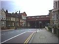
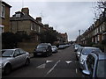
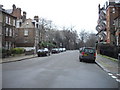
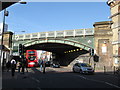
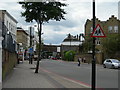
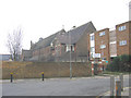
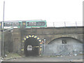
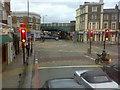
100 photos from this area
Area Information
Key information about the SW11 5UP including its size, population, and administrative classification.
- Area Type
- Postcode
- Area Size
- 3899 m²
- Population
- 1685
- Population Density
- 17578 people/km²
House Prices in SW11 5UP
35
Properties
£713,088
Average Sold Price
£315,000
Lowest Price
£1,150,000
Highest Price
Showing 35 properties
| Address | Type | Beds | Baths | Last Sale Price | Last Sale Date | |
|---|---|---|---|---|---|---|
| 48 Holden Street, London, SW11 5UP | Terraced | 3 | 2 | £1,025,000 | Dec 2024 | |
| 44 Holden Street, London, SW11 5UP | Semi-detached | 2 | 1 | £900,000 | Jul 2024 | |
| 32 Holden Street, London, SW11 5UP | Terraced | 3 | 2 | £1,150,000 | Nov 2023 | |
| 58 Holden Street, London, SW11 5UP | house | - | - | £830,000 | Jun 2021 | |
| 70 Holden Street, London, SW11 5UP | house | 2 | 1 | £840,000 | Mar 2021 | |
| 66 Holden Street, London, SW11 5UP | Terraced | 2 | 1 | £810,000 | Sep 2020 | |
| 34 Holden Street, London, SW11 5UP | Terraced | 2 | 1 | £782,500 | Jun 2020 | |
| 54 Holden Street, London, SW11 5UP | Terraced | 3 | 1 | £650,000 | Mar 2020 | |
| 18 Holden Street, London, SW11 5UP | house | - | - | £930,000 | Apr 2019 | |
| 22 Holden Street, London, SW11 5UP | Terraced | 3 | 2 | £955,000 | Jun 2015 |
Page 1 of 4
Energy Efficiency in SW11 5UP
Amenities
Schools
| Rank | School | Type | Entry gender | Ages |
|---|
Explore more schools in this area
Go to Schools tabDemographics
Household Size
Two person
most common
Accommodation Type
Houses
most common
Tenure
28
majority
Ethnic Group
White
most common
Religion
N/A
most common
Household Composition
N/A
most common
Age
47
median
Adults (30-64 years)
most common
Household Deprivation
N/A
with no deprivation
NS-SEC
47
in Lower managerial occupations
Explore more demographic insights in this area
Go to Demographics tabPlanning
Planning Constraints
- Flood RiskPremium
- Ramsar Wetland SitesPremium
- Area of Outstanding Natural BeautyPremium
- Protected Nature ReservePremium
- Protected WoodlandPremium