Area Overview for SW11 5LH
Photos of SW11 5LH

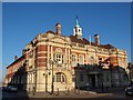

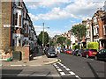
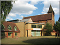
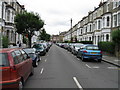
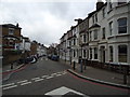
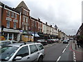
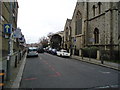
100 photos from this area
Area Information
Key information about the SW11 5LH including its size, population, and administrative classification.
- Area Type
- Postcode
- Area Size
- 5520 m²
- Population
- 1685
- Population Density
- 17578 people/km²
House Prices in SW11 5LH
40
Properties
£659,250
Average Sold Price
£155,000
Lowest Price
£1,175,000
Highest Price
Showing 40 properties
| Address | Type | Beds | Baths | Last Sale Price | Last Sale Date | |
|---|---|---|---|---|---|---|
| 125 Elsley Road, London, SW11 5LH | Terraced | 3 | - | £850,000 | Sep 2023 | |
| 119 Elsley Road, London, SW11 5LH | Terraced | 2 | 2 | £875,000 | Mar 2023 | |
| 127 Elsley Road, London, SW11 5LH | Terraced | 4 | 2 | £1,175,000 | Jul 2022 | |
| 136 Elsley Road, London, SW11 5LH | Terraced | 3 | - | £1,000,000 | Jan 2022 | |
| 122 Elsley Road, London, SW11 5LH | Terraced | 2 | 1 | £847,500 | Nov 2021 | |
| 124 Elsley Road, London, SW11 5LH | house | - | - | £982,000 | Apr 2021 | |
| 146 Elsley Road, London, SW11 5LH | house | - | - | £860,000 | Mar 2021 | |
| 115 Elsley Road, London, SW11 5LH | house | 2 | - | £950,000 | Aug 2020 | |
| 137 Elsley Road, London, SW11 5LH | house | - | - | £862,500 | May 2019 | |
| 112 Elsley Road, London, SW11 5LH | Terraced | 2 | 1 | £875,000 | Jul 2017 |
Page 1 of 4
Energy Efficiency in SW11 5LH
Amenities
Schools
| Rank | School | Type | Entry gender | Ages |
|---|
Explore more schools in this area
Go to Schools tabDemographics
Household Size
Two person
most common
Accommodation Type
Houses
most common
Tenure
28
majority
Ethnic Group
White
most common
Religion
N/A
most common
Household Composition
N/A
most common
Age
47
median
Adults (30-64 years)
most common
Household Deprivation
N/A
with no deprivation
NS-SEC
47
in Lower managerial occupations
Explore more demographic insights in this area
Go to Demographics tabPlanning
Planning Constraints
- Flood RiskPremium
- Ramsar Wetland SitesPremium
- Area of Outstanding Natural BeautyPremium
- Protected Nature ReservePremium
- Protected WoodlandPremium