Area Overview for SW11 5BT
Photos of SW11 5BT

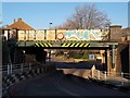
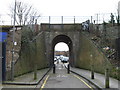
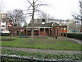
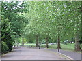
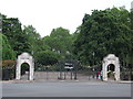

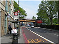

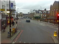
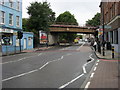
100 photos from this area
Area Information
Key information about the SW11 5BT including its size, population, and administrative classification.
- Area Type
- Postcode
- Area Size
- 3717 m²
- Population
- 2235
- Population Density
- 16118 people/km²
House Prices in SW11 5BT
24
Properties
£482,413
Average Sold Price
£75,000
Lowest Price
£774,000
Highest Price
Showing 24 properties
| Address | Type | Beds | Baths | Last Sale Price | Last Sale Date | |
|---|---|---|---|---|---|---|
| 116 Sheepcote Lane, London, SW11 5BT | Flat | - | - | £560,000 | Jun 2024 | |
| 92 Sheepcote Lane, London, SW11 5BT | Detached | 3 | 1 | £640,000 | Feb 2024 | |
| 96 Sheepcote Lane, London, SW11 5BT | Terraced | 3 | 2 | £710,000 | Jun 2021 | |
| 102 Sheepcote Lane, London, SW11 5BT | Terraced | 4 | 2 | £710,000 | Apr 2021 | |
| 98 Sheepcote Lane, London, SW11 5BT | Terraced | 3 | 2 | £774,000 | Mar 2020 | |
| 144 Sheepcote Lane, London, SW11 5BT | Flat | 2 | 1 | £607,400 | Nov 2019 | |
| 138 Sheepcote Lane, London, SW11 5BT | Flat | - | - | £513,550 | Feb 2019 | |
| 124 Sheepcote Lane, London, SW11 5BT | Flat | 3 | 1 | £515,000 | Jul 2014 | |
| 94 Sheepcote Lane, London, SW11 5BT | Flat | - | - | £295,000 | Jun 2006 | |
| 104 Sheepcote Lane, London, SW11 5BT | house | - | - | £239,000 | Aug 2004 |
Page 1 of 3
Energy Efficiency in SW11 5BT
Amenities
Schools
| Rank | School | Type | Entry gender | Ages |
|---|
Explore more schools in this area
Go to Schools tabDemographics
Household Size
Two person
most common
Accommodation Type
Flats
most common
Tenure
33
majority
Ethnic Group
White
most common
Religion
N/A
most common
Household Composition
N/A
most common
Age
47
median
Adults (30-64 years)
most common
Household Deprivation
N/A
with no deprivation
NS-SEC
47
in Lower managerial occupations
Explore more demographic insights in this area
Go to Demographics tabPlanning
Planning Constraints
- Flood RiskPremium
- Ramsar Wetland SitesPremium
- Area of Outstanding Natural BeautyPremium
- Protected Nature ReservePremium
- Protected WoodlandPremium