Area Overview for SW11 2LU
Photos of SW11 2LU
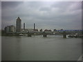
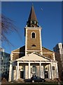
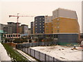
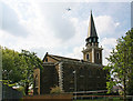
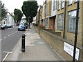
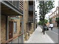
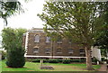
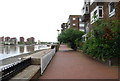
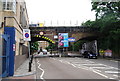
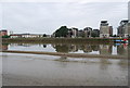
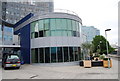
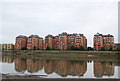
100 photos from this area
Area Information
Key information about the SW11 2LU including its size, population, and administrative classification.
- Area Type
- Postcode
- Area Size
- 8678 m²
- Population
- 1696
- Population Density
- 17882 people/km²
House Prices in SW11 2LU
94
Properties
£262,219
Average Sold Price
£55,000
Lowest Price
£450,000
Highest Price
Showing 94 properties
| Address | Type | Beds | Baths | Last Sale Price | Last Sale Date | |
|---|---|---|---|---|---|---|
| 84 Fawcett Close, London, SW11 2LU | Flat | - | - | £395,000 | Dec 2025 | |
| 40 Fawcett Close, London, SW11 2LU | Flat | 2 | 1 | £445,000 | Dec 2025 | |
| 38 Fawcett Close, London, SW11 2LU | Flat | 2 | 1 | £450,000 | Sep 2025 | |
| 108 Fawcett Close, London, SW11 2LU | Detached | 4 | 4 | £300,000 | Feb 2025 | |
| 120 Fawcett Close, London, SW11 2LU | Flat | 1 | 1 | £320,000 | Nov 2022 | |
| 66 Fawcett Close, London, SW11 2LU | Flat | - | - | £400,000 | Sep 2022 | |
| 64 Fawcett Close, London, SW11 2LU | Flat | 1 | 1 | £322,500 | Jan 2022 | |
| 122 Fawcett Close, London, SW11 2LU | Flat | - | - | £264,000 | Jul 2013 | |
| 102 Fawcett Close, London, SW11 2LU | Flat | 2 | 2 | £210,000 | Apr 2013 | |
| 86 Fawcett Close, London, SW11 2LU | Flat | 2 | 1 | £245,000 | Feb 2011 |
Page 1 of 10
Energy Efficiency in SW11 2LU
Amenities
Schools
| Rank | School | Type | Entry gender | Ages |
|---|
Explore more schools in this area
Go to Schools tabDemographics
Household Size
One person
most common
Accommodation Type
Flats
most common
Tenure
24
majority
Ethnic Group
White
most common
Religion
N/A
most common
Household Composition
N/A
most common
Age
47
median
Adults (30-64 years)
most common
Household Deprivation
N/A
with no deprivation
NS-SEC
32
in Lower managerial occupations
Explore more demographic insights in this area
Go to Demographics tabPlanning
Planning Constraints
- Flood RiskPremium
- Ramsar Wetland SitesPremium
- Area of Outstanding Natural BeautyPremium
- Protected Nature ReservePremium
- Protected WoodlandPremium