Area Overview for Surbiton Hill Ward
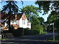
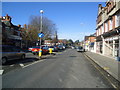
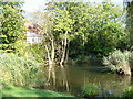
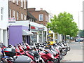
Photos of Surbiton Hill Ward
Area Information
Surbiton Hill Ward is an urban locality within the broader Surbiton suburban area in the Royal Borough of Kingston upon Thames. You will find this district approximately 11 miles southwest of Charing Cross, forming a distinct part of the South West London region. The ward covers a compact area of 1.7 km² and elects three councillors to the local council. Historical context reveals that this area emerged after a specific routing decision in the 1830s, when a London-Southampton railway line was diverted south of the hill to protect the local coaching trade. Surbiton railway station opened in 1838 and later became a central hub for residents. Today, the terrain is relatively flat with a small hill near its centre, bordered by the Borough of Elmbridge in Surrey. Living in Surbiton Hill Ward offers access to a well-established suburban setting that functions as a popular commuter hub. The ward was first used in the 1964 elections, grounding its history deep within the London development timeline. You can expect an environment shaped by 19th-century infrastructure and modern commuter lifestyles, blending historical character with contemporary convenience.
- Area Type
- District Borough Unitary Ward
- Area Size
- 1.7 km²
- Population
- 1535
- Population Density
- 914 people/km²
Demographics
The community profile of Surbiton Hill Ward reveals a population of 1535 residents across the 1.7 km² area. While broader census data for Kingston upon Thames wards suggests around 10,636 residents in related Surbiton Hill figures, the specific ward unit shows 1,535 people. The residential demographic has a median age of 70 years, indicating a settlement dominated by older residents. This age profile distinguishes the ward from younger, family-centred London suburbs. Home ownership sits at 47 per cent within the ward, meaning roughly half of the households own their property outright or with a mortgage. The remaining 53 per cent of households are in the rental sector or other tenures. The ward operates as a residential ward with no breakdown provided for specific family compositions or ethnic demographics in the current data. Planning constraints are absent in this locality; there is no Ramsar wetland coverage, no Area of Outstanding Natural Beauty designation, and no protected nature reserves or woodland within the boundaries. This clear status suggests straightforward planning considerations for those assessing the long-term development potential of homes in this specific ward.
Household Size
Accommodation Type
Tenure
Ethnic Group
Religion
Household Composition
Age
Household Deprivation
NS-SEC
Explore more demographic insights in this area
Go to Demographics tabPlanning
Planning Constraints
- Flood RiskPremium
- Ramsar Wetland SitesPremium
- Area of Outstanding Natural BeautyPremium
- Protected Nature ReservePremium
- Protected WoodlandPremium
- Crime RiskPremium