Area Overview for Stratford Olympic Park Ward
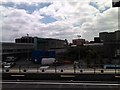
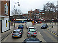
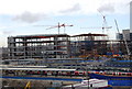
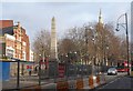
Photos of Stratford Olympic Park Ward


Area Information
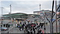
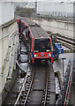
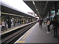
Stratford Olympic Park Ward covers 1.8 square kilometres and serves as a compact district within the London Borough of Newham. This small area holds a population of 4,805 residents, creating a very high population density of 2,642 people per square kilometre. You will find the vicinity wraps around the former Olympic facilities, situated just north of the Olympic Park boundary. Daily life here moves quickly due to the close proximity of major transport hubs and the dense built environment. The ward functions as a residential extension to the wider Stratford regeneration zone rather than a standalone village. You live close to the North Circular Road, which provides extensive links to the surrounding boroughs. The area benefits from immediate access to vast green spaces within the Olympic Park, yet remains tightly packed with housing. This specific ward does not contain large open fields or rural characteristics; instead, the landscape is defined by urban development and high-rise construction. Living in Stratford Olympic Park Ward means navigating a bustling environment where every square metre is utilised for housing or communal infrastructure. The location offers direct proximity to Canary Wharf and the City of London, though you must contend with the physical constraints of such a small footprint. Your immediate neighbourhood is characterised by modern developments sitting adjacent to established residential blocks. You receive quick access to major retail parks and entertainment venues without needing to travel far. The compact nature of the 1.8 square kilometre area ensures that destinations are within walking distance or a short bus ride away.
- Area Type
- District Borough Unitary Ward
- Area Size
- 1.8 km²
- Population
- 4805
- Population Density
- 2642 people/km²
Demographics
The community within Stratford Olympic Park Ward shows a significant concentration of older residents. The median age for the population sits at 70 years, indicating that the majority of households are chaired by retirees or older couples. You are dealing with a demographic where Age: Total is the prevailing classification for the most common age range, reinforcing the mature nature of the ward. Only 24% of residents own their homes outright, which suggests a high proportion of tenanted properties. This low ownership rate of 24% means that renting remains the dominant lifestyle choice for most families residing in the area. Household composition data reflects the wider trends of an older population, though specific breakdowns for single-person versus multi-generational homes are aggregated under total household composition for this ward. The population density of 2,642 people per square kilometre creates a lively atmosphere where neighbours interact frequently within a tightly knit setting. Economic considerations for residents are influenced by the high rental sector presence, as only a quarter of the 4,805 residents hold title deeds to their property. Ageing demographics often correlate with changing service needs, including a greater demand for healthcare and accessibility features. You should consider how the high percentage of rental occupants shapes the local property dynamics and community stability. The ward acts as a settlement for those who have moved closer to central London jobs or for pensioners downsizing to flats in the Olympic vicinity. The total population figure of 4,805 residents living in such a small area necessitates efficient planning and ample shared space to prevent overcrowding.
Household Size
Accommodation Type
Tenure
Ethnic Group
Religion
Household Composition
Age
Household Deprivation
NS-SEC
Explore more demographic insights in this area
Go to Demographics tabPlanning
Planning Constraints
- Flood RiskPremium
- Ramsar Wetland SitesPremium
- Area of Outstanding Natural BeautyPremium
- Protected Nature ReservePremium
- Protected WoodlandPremium
- Crime RiskPremium