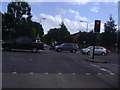
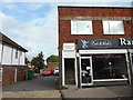
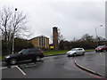
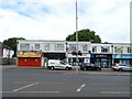
Area Overview for Stonecot Ward
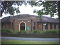
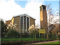
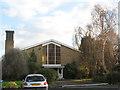
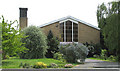
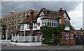
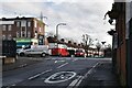
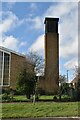
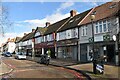
Photos of Stonecot Ward
Area Information
Stonecot Ward is a defined district within the London Borough of Sutton, situated in south-west London. The area covers 1.6 km² and holds a population of 1,564. These figures define a relatively compact neighbourhood with a population density of 1,000 people per km². Living in Stonecot Ward means joining a community established as a London borough ward under Sutton Borough Council, a designation used since elections began in 2002. The location sits at specific geographic coordinates, placing it firmly within the administrative boundaries of the borough. This ward exists alongside other historical estimates that place household figures around 6,500 from the 2011 census, though current official counts stand at the lower figure of 1,564. The combination of small area size and moderate density suggests a contained environment rather than a sprawling suburb. Residents of Stonecot Ward experience a settlement where space and population are balanced within the official ward boundaries. Daily life here is characterised by the specific administrative framework of Sutton Borough Council and the physical constraints of the 1.6 km² footprint. You enter a defined space where governance, services, and community planning are managed at this ward level within the larger borough structure.
- Area Type
- District Borough Unitary Ward
- Area Size
- 1.6 km²
- Population
- 1564
- Population Density
- 1000 people/km²
Demographics
The community profile of Stonecot Ward is dominated by older residents, with a median age of 70 years. This indicates a retirement-focused demographic where the majority of inhabitants fall into the age range classified as total in the dataset, reflecting a mature population. Home ownership is the prevailing form of accommodation, securing 80% of households. This high rate of owner occupation creates a settled environment where residents have a long-term stake in their local area. The remaining 20% of housing is likely occupied by renters, forming a smaller minority within the ward's demographic mix. There is no data provided regarding specific household composition breakdowns, predominant ethnic groups, or religious affiliations, so these aspects remain unquantified in the available statistics. The absence of provided data on deprivation levels means that the quality of life picture relies heavily on the visible stability of the high ownership rate and the older age profile. You can expect a resident base that is primarily older adults, with a strong cultural emphasis on property ownership rather than renting. The low population density of 1,000 people per km² combined with this age profile suggests an area designed for or settled by those seeking quiet residential surroundings rather than dense urban living.
Household Size
Accommodation Type
Tenure
Ethnic Group
Religion
Household Composition
Age
Household Deprivation
NS-SEC
Explore more demographic insights in this area
Go to Demographics tabPlanning
Planning Constraints
- Flood RiskLocked
- Ramsar Wetland SitesLocked
- Area of Outstanding Natural BeautyLocked
- Protected Nature ReserveLocked
- Protected WoodlandLocked
- Crime RiskLocked