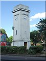
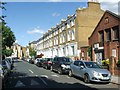
Area Overview for Stockwell West & Larkhall Ward
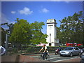
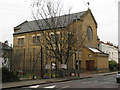
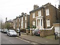
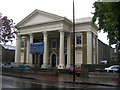
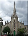
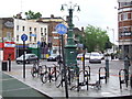
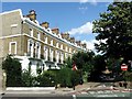
Photos of Stockwell West & Larkhall Ward


Area Information
Stockwell West & Larkhall Ward is an electoral ward within the London Borough of Lambeth, situated in the London region of England. This district covers approximately 97.6 hectares, positioning it as a defined local government unit for the 2022 elections. The area functions as a specific political and administrative zone, distinct from the larger Stockwell ward that existed between 1965 and 2022. Residents here navigate a locality that shifted its boundaries and name during the recent local governance restructuring. You are looking at a footprint of nearly a square kilometre that serves a specific community need within the borough. The ward includes the Larkhall geographical area, which is integrated into this electoral designation. Daily life here revolves around the practicalities of being part of this updated local structure. The landscape is urban, typical of a London borough ward, rather than being defined by rural features or national parks. When you consider homes in Stockwell West & Larkhall Ward, you are entering a settled environment with clear administrative boundaries established in early 2022. This area represents a specific slice of Lambeth where local council services and elections take place within these exact coordinates. The history of the ward spans from its creation in 2022, marking a departure from the previous territorial divisions in the area. It is a functional part of the Greater London infrastructure, offering a residential experience centred on these specific administrative lines.
- Area Type
- District Borough Unitary Ward
- Area Size
- 97.6 hectares
- Population
- Not available
- Population Density
- Not available
Demographics
The community profile in Stockwell West & Larkhall Ward reveals a very mature population structure. The median age recorded for the area is 70, indicating that half of the residents are 70 years old or older. This demographic skew suggests the area is home to a large number of older adults, seniors, and retirees. The data explicitly states the most common age range is listed as "Age: Total", which serves as a categorical descriptor for the full population census data collected. With a home ownership rate of just 22 percent, the majority of households in this ward do not own their properties outright. This low figure implies that rental living is the dominant mode of housing for residents in Stockwell West & Larkhall Ward. You will find that most people live in rented accommodation rather than owning a freehold or leasehold property. The household composition and predominant ethnic group statistics are available only as total categories in the current dataset, providing a complete count but without breaking down specific sub-groups in the provided summary. This means the ward contains a significant proportion of older residents living privately rented or sheltered housing. The combination of a median age of 70 and a 22 percent ownership rate paints a picture of an area where many long-term residents lease their homes. This demographic reality shapes the local services, transport needs, and community dynamics found within the 97.6 hectares of this ward.
Household Size
Accommodation Type
Tenure
Ethnic Group
Religion
Household Composition
Age
Household Deprivation
NS-SEC
Explore more demographic insights in this area
Go to Demographics tabPlanning
Planning Constraints
- Flood RiskPremium
- Ramsar Wetland SitesPremium
- Area of Outstanding Natural BeautyPremium
- Protected Nature ReservePremium
- Protected WoodlandPremium
- Crime RiskPremium