Area Overview for St. Pancras & Somers Town Ward
Photos of St. Pancras & Somers Town Ward

Area Information
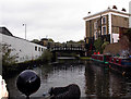
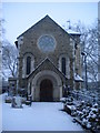
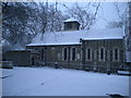
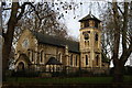
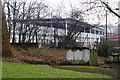
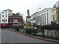
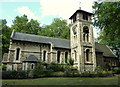
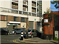
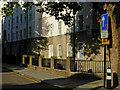
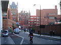
Living in St. Pancras & Somers Town Ward means residing in a historic district within the London Borough of Camden, north London. This ward spans 82.5 hectares and is defined by its position amongst three major railway termini. Euston, Kings Cross, and St Pancras Station anchor the area, creating a constant hum of transport activity. The ward lies in the NW1 postcode area, centred around Chalton Street, with boundaries marked by Euston Road, Eversholt Street, Crowndale Road, and Pancras Road. You will find yourself amidst a community that has evolved significantly since the 1790s, when Earl Camden first developed the land north and west of St Pancras Old Church. Daily life here is shaped by the legacy of the railway boom. Initial Georgian developments like the Polygon attracted French Revolution refugees before the area faced severe overcrowding. The construction of Euston Station in 1834 reshaped Somers Town, turning a thriving working-class community into something else entirely under Lord Somers. Father Basil Jellicoe later championed improvements in the nineteenth century, securing support from Queen Mary and the Prince of Wales to build better housing. Today, you walk past the Sidney Street estate, completed in 1938. These blocks, named after saints, include St George's, which was the first all-electric apartment block in the United Kingdom. The area remains characterised by dense Council-owned blocks and survivors of the original Georgian architecture.
- Area Type
- District Borough Unitary Ward
- Area Size
- 82.5 hectares
- Population
- Not available
- Population Density
- Not available
Demographics
The demographic picture of St. Pancras & Somers Town Ward reveals a population with a median age of 70. This high median age indicates a significant number of older residents within the ward. Most household data under the 'Total' category confirms the breadth of this age distribution across the community. The area has recorded a population of 13,818 at the 2011 Census, showing a relatively tight-knit but ageing demographic. The ward is among the 10% most deprived areas in the country, a fact that influences the everyday experience for residents. High deprivation levels often correlate with specific social challenges and lower average incomes in this district. You will find a concentration of less affluent residents, students, and refugees living alongside the older population. This mix creates a dynamic but economically pressured environment. The ward's character is defined by this socio-economic reality rather than by wealth. While specific breakdowns of predominant ethnic groups or religious affiliations are not detailed in current records, the history shows a legacy of diversity, from the French Revolution refugees to the modern-day student population. The high median age suggests that the area serves as a retirement hub for many, even as younger generations seek housing nearby. Living here requires an awareness of the stark contrast between the area's rich architectural history and its current status as one of the nation's most socially deprived zones.
Household Size
Accommodation Type
Tenure
Ethnic Group
Religion
Household Composition
Age
Household Deprivation
NS-SEC
Explore more demographic insights in this area
Go to Demographics tabPlanning
Planning Constraints
- Flood RiskPremium
- Ramsar Wetland SitesPremium
- Area of Outstanding Natural BeautyPremium
- Protected Nature ReservePremium
- Protected WoodlandPremium
- Crime RiskPremium