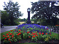
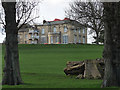
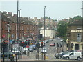
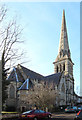
Area Overview for St. Martin's Ward
Photos of St. Martin's Ward


Area Information
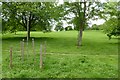
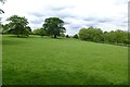
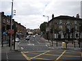
St. Martin's Ward is a distinct borough unitary ward located in England, covering a total area of 87.3 hectares. Living in St. Martin's Ward offers a specific locality defined by its modest geographic footprint compared to the broader urban sprawl often found in neighbouring regions. The area functions as a self-contained district where residents navigate daily life within clear spatial boundaries. You will find that the environment is characterised by defined limits, creating a neighbourhood that feels contained yet integrated into the wider county structure. The ward represents a specific administrative zone where local governance and community planning operate within these fixed 87.3 hectares. Prospective homebuyers considering homes in St. Martin's Ward should understand the scale of the locality immediately. A space of this size suggests a concentrated community where distances between amenities are short, yet the area maintains a structured identity. Daily life here revolves around the specific constraints and advantages of this particular ward boundary. The population density within these 87.3 hectares creates a living environment where neighbours are close by, fostering a sense of local interdependence. You are entering a space where the built environment directly interacts with the available land, resulting in a defined residential experience. This area is not a sprawling expanse but a focused district where the character of St. Martin's Ward is shaped by its manageable size and clear administrative status.
- Area Type
- District Borough Unitary Ward
- Area Size
- 87.3 hectares
- Population
- Not available
- Population Density
- Not available
Demographics
The community profile within St. Martin's Ward is heavily skewed towards an older demographic. You will find that the median age of residents is 70, indicating a population where pensioners and retirees form the significant majority. This age distribution shapes the social rhythm of the ward, with most days likely reflecting the pace of life preferred by an older generation. Families with young children are less common, while household stability tends to be higher as long-term residents settle into their properties. Living in St. Martin's Ward means engaging with a cohort that values established routines over rapid change. Home ownership in the area stands at 34%, meaning that over two-thirds of residents likely reside in rental properties. This high proportion of tenanted homes distinguishes the ward from areas where majority ownership drives community investment. You may find that landlords and estate agents play a more visible role than in owner-occupied neighbourhoods. The total household composition data confirms that accommodation types are diverse, though the specific breakdown of flats versus houses remains part of the broader total. The predominant ethnic group and religious affiliation data indicate a specific cultural makeup, though exact percentages require deeper regional context. This demographic reality creates a social fabric where national pension trends and local housing policies intersect closely.
Household Size
Accommodation Type
Tenure
Ethnic Group
Religion
Household Composition
Age
Household Deprivation
NS-SEC
Explore more demographic insights in this area
Go to Demographics tabPlanning
Planning Constraints
- Flood RiskPremium
- Ramsar Wetland SitesPremium
- Area of Outstanding Natural BeautyPremium
- Protected Nature ReservePremium
- Protected WoodlandPremium
- Crime RiskPremium