Area Overview for St. James Ward
Photos of St. James Ward


Area Information
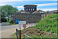
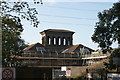
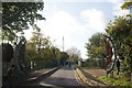
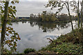
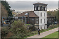
Living in St. James Ward offers a residence deeply rooted in royal history and central London prestige. This district forms part of the West End, occupying a compact 3.1 square kilometre area. You will find yourself situated between Piccadilly to the north, Haymarket to the east, St. James's Street to the west, and Pall Mall to the south. The neighbourhood originates from the northwestern gardens of St. James's Palace, creating a streetscape defined by manicured green spaces and grand architecture. Key landmarks include St. James's Park, Green Park, and St. James's Square, which define the dailyViews enjoyed from properties in St. James Ward. The Jermyn Street layout reflects its aristocratic origins as a hub for gentlemen's shops and luxury retailers. You are walking distance to St. James's Church, Piccadilly, designed by Christopher Wren and consecrated in 1684. Daily life revolves around proximity to senior royal residences and historic townhouses leased by aristocracy in the 17th century. The area retains its status as a quintessential part of the City of Westminster without feeling distant from the capital's core. Homes here blend historical significance with modern convenience, offering a residential experience within one of London's most significant historical zones. The density of parks and low density of traffic allow for a unique urban retreat despite being centrally located.
- Area Type
- District Borough Unitary Ward
- Area Size
- 3.1 km²
- Population
- Not available
- Population Density
- Not available
Demographics
The community residing in St. James Ward has a distinctly older profile compared to many other London districts. Data indicates a median age of 70 years for residents, reflecting a population dominated by senior citizens. The age breakdown shows that the "Total" category represents the most common demographic grouping, suggesting a relatively homogenous age distribution across the ward. You will find that nearly half of all households own their homes, with a home ownership figure of 49%. This statistic mirrors the tenure of residents across the entire ward rather than specific property types. Accommodation types are aggregated into a single "Total" category, meaning specific data on flats versus houses is not broken down for this area. The demographic slip also lists household composition and predominant ethnic groups as "Total", indicating that comprehensive diversity statistics are combined into a single aggregate figure. Religion data similarly falls under the "Total" classification, lacking a specific breakdown for different faiths within the ward. Deprivation data is not detailed in the available records, so you cannot directly compare living standards against national metrics using specific indices. Instead, the dominance of high-income associated with the area's history suggests a generally affluent environment where residents often own their freehold properties.
Household Size
Accommodation Type
Tenure
Ethnic Group
Religion
Household Composition
Age
Household Deprivation
NS-SEC
Explore more demographic insights in this area
Go to Demographics tabPlanning
Planning Constraints
- Flood RiskPremium
- Ramsar Wetland SitesPremium
- Area of Outstanding Natural BeautyPremium
- Protected Nature ReservePremium
- Protected WoodlandPremium
- Crime RiskPremium