Area Overview for St. Helier Ward
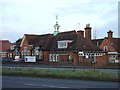
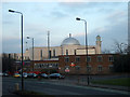
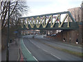
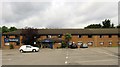
Photos of St. Helier Ward
Area Information
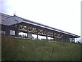
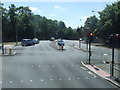
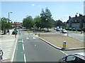
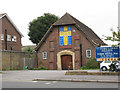
St. Helier Ward is a compact district within the London Borough of Sutton, covering an area of just 1.4 square kilometres. Located near the Wandle Valley, this ward serves as a historic boundary child ward that has evolved over recent years. In 2022, the single ward split into two distinct constituencies for local elections: St Helier East and St Helier West. This new arrangement sees St Helier East elect two councillors, while St Helier West elects three, reflecting changes in how the community is represented. The ward is accessible from the east via West Street, which runs off the A232. Major visitors and patients to St. Helier Hospital navigate this route to reach the medical facilities on Wrythe Lane. Properties in St. Helier Ward benefit from proximity to the Queen Mary's Hospital for Children and other NHS trusts. The area centre coordinates at 51.394422161748 and -0.19348926638678635 place it firmly in south London. Living in St. Helier Ward offers residents direct access to significant healthcare infrastructure without the need for a bus ride or long train journey to a hospital site.
- Area Type
- District Borough Unitary Ward
- Area Size
- 1.4 km²
- Population
- Not available
- Population Density
- Not available
Demographics
The community profile of St. Helier Ward reveals an ageing population with a median age of 70 years. This demographic concentration significantly influences daily life and local services. While the most common age range category is simply listed as 'Total', the high median age suggests a neighbourhood dominated by older residents. Current home ownership stands at 48%, indicating that homeowners and renters live in roughly equal proportions within the ward. The available household composition and accommodation type data show aggregate totals but do not break down specific unit mixes in this limited dataset. Diversity across predominant ethnic groups and religious affiliations remains unspecified in the current records, meaning a granular view of cultural makeup is not immediately visible. The elder-heavy profile means families with young children form a smaller segment of the local population. Despite the lack of detailed diversity metrics, the social fabric is defined by this mature demographic. Anyone considering homes in St. Helier Ward must understand that the environment caters primarily to older adults rather than young families. The 48% ownership rate suggests a balanced market where both landlords and veteran owners secure their properties. Understanding these figures helps buyers align their lifestyle expectations with the actual residents of St. Helier Ward.
Household Size
Accommodation Type
Tenure
Ethnic Group
Religion
Household Composition
Age
Household Deprivation
NS-SEC
Explore more demographic insights in this area
Go to Demographics tabPlanning
Planning Constraints
- Flood RiskPremium
- Ramsar Wetland SitesPremium
- Area of Outstanding Natural BeautyPremium
- Protected Nature ReservePremium
- Protected WoodlandPremium
- Crime RiskPremium