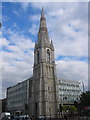
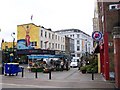
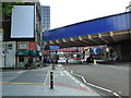
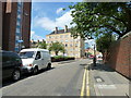
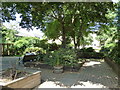
Area Overview for St. George's Ward
Photos of St. George's Ward


Area Information
St. George's Ward is a district borough unitary ward covering 57.4 hectares of land. This specific administrative area is located in England and represents a defined geographical unit for local governance. The search does not provide detailed historical context or notable features to elaborate on the ward's unique character beyond its official designation. Despite these limitations, the area maintains a significant digital presence with high-speed internet access. Digital connectivity here supports fixed broadband quality scores of 89 out of 100. This rating suggests residents can expect reliable internet for remote work and daily activities. The ward's small physical size contrasts with the broad administrative role it plays within the larger borough structure. Living in St. George's Ward involves navigating a community with specific demographic markers, where the average resident is significantly older than the national norm. You should expect an environment shaped by recent residential trends rather than long-standing industrial or commercial history. The area's identity is currently defined by its housing stock statistics and safety profiles rather than famous landmarks or economic hubs. Prospective buyers viewing homes in St. George's Ward must consider the stark statistical realities presented by local assessments.
- Area Type
- District Borough Unitary Ward
- Area Size
- 57.4 hectares
- Population
- Not available
- Population Density
- Not available
Demographics
The community within St. George's Ward displays a distinctly mature age profile. The median age of residents is 70, indicating a population skewed heavily towards older age groups. You are unlikely to find a young family demographic as the most common age range data suggests a broad total distribution centred on senior citizens. This demographic structure influences the local service needs and social atmosphere significantly. Home ownership stands at 27 per cent, meaning the vast majority of residents are renting their accommodation. This high rental percentage defines the financial landscape for individuals moving into the ward. The area does not report specific breakdowns for accommodation types beyond the total figure, nor does it detail the predominant ethnic groups or religious affiliations. Consequently, the social fabric appears defined more by age and occupancy status than by cultural or religious segmentation. For those considering living in St. George's Ward, the data confirms a retirement-focused environment. The low ownership rate suggests a transient or rental-heavy lifestyle rather than one where families stay for generations. Buyers must understand that purchasing a home here may be less common than renting from existing owners or landlords. The demographic reality creates a specific set of neighbourhood dynamics that cater primarily to an older, renting population.
Household Size
Accommodation Type
Tenure
Ethnic Group
Religion
Household Composition
Age
Household Deprivation
NS-SEC
Explore more demographic insights in this area
Go to Demographics tabPlanning
Planning Constraints
- Flood RiskPremium
- Ramsar Wetland SitesPremium
- Area of Outstanding Natural BeautyPremium
- Protected Nature ReservePremium
- Protected WoodlandPremium
- Crime RiskPremium