Area Overview for St. Edward's Ward
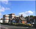
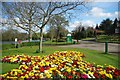
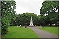
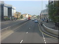
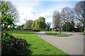
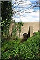
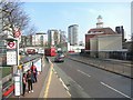
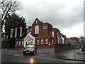
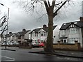
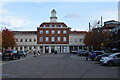
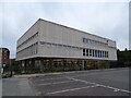
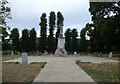
Photos of St. Edward's Ward
Area Information
Living in St. Edward's Ward offers a compact and defined residential experience within the borough unitary ward. This small district covers just 1.8 km², ensuring that daily necessities and local routes remain within easy reach for all residents. You step into a neighbourhood where the scale of development is tightly controlled by its limited geographic footprint. The area functions as a cohesive community where distances between homes and amenities are naturally short. Prospective buyers entering the market here will find a location characterised by its manageable size and established residential nature. The ward serves as a distinct pocket of real estate within the broader urban or semi-urban fabric of England. Anyone considering homes in St. Edward's Ward should appreciate the simplicity provided by such a restricted area size. There is no sprawling commute required within the ward boundaries itself, which can greatly benefit those seeking a quieter domestic life. The 1.8 km² boundary acts as a natural filter for traffic and development pressure. You will likely interact with the same neighbours frequently due to the high density of housing within this small perimeter. This concentration creates a stable environment where local services cater specifically to the immediate needs of the residents. The ward represents a straightforward choice for buyers who value simplicity and proximity. Whether you are looking for a quick walk to local shops or a short drive to major transport links outside the immediate perimeter, the layout supports an efficient lifestyle. The compactness of the ward ensures that nothing is far away, making it a practical option for those who dislike long commutes within their own neighbourhood. You gain a sense of place that is easy to navigate and covers a specific stretch of lived-in territory.
- Area Type
- District Borough Unitary Ward
- Area Size
- 1.8 km²
- Population
- Not available
- Population Density
- Not available
Demographics
The community in St. Edward's Ward is distinctly older, with a demographic profile that centres heavily on senior residents. The median age for the population is 70, indicating that the majority of households consist of older adults rather than young families or professionals. This age distribution shapes the local culture and the types of services that function effectively within the ward. You are likely to encounter a population where the primary age range falls within the senior bracket, which influences everything from business hours to community activities. Home ownership stands at 54%, meaning just over half of the residents in the ward own their properties outright or with a mortgage. The remaining households typically rent or live in shared arrangements, though the high ownership rate suggests significant stability. This figure is a crucial statistic for anyone assessing the security of tenure in the area. With more than half of the residents owning their homes, there is a strong sense of long-term investment in the neighbourhood. Household composition remains a total calculation in the available records, yet the age data points strongly towards smaller, single-person or couple-only households common among the elderly. The area does not show specific data on predominant ethnicity or religious affiliation in the provided figures, so those aspects of diversity remain unquantified here. Nevertheless, the high level of home ownership often correlates with a settled, resident-focused community where people have lived for many years. You should expect a quiet environment dominated by retirees who have perhaps chosen this location for its accessibility and established amenities. The 54% ownership rate confirms that this is largely an area where residents put down roots for the long haul.
Household Size
Accommodation Type
Tenure
Ethnic Group
Religion
Household Composition
Age
Household Deprivation
NS-SEC
Explore more demographic insights in this area
Go to Demographics tabPlanning
Planning Constraints
- Flood RiskPremium
- Ramsar Wetland SitesPremium
- Area of Outstanding Natural BeautyPremium
- Protected Nature ReservePremium
- Protected WoodlandPremium