Area Overview for Southfield Ward
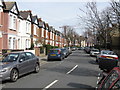
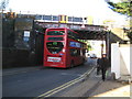
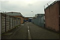
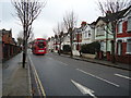
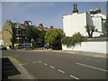
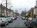
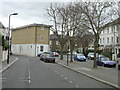
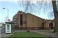
Photos of Southfield Ward
Area Information
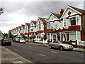
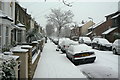
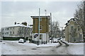
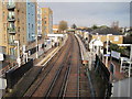
Southfield Ward is a distinct electoral ward situated within the London Borough of Ealing in West London. This area covers a compact footprint of 1.5 square kilometres, yet it accommodates a population of 1,736 residents. You will find the ward positioned near the localities of Acton Green and Chiswick, existing adjacent to notable landmarks such as Burlington Gardens and Acton Central railway station. The location operates within Travelcard Zone 3, placing it approximately 6.1 miles west of Charing Cross. Historical records indicate the ward was first established for elections in 1964 and currently elects three councillors to the Ealing London Borough Council. While often associated with the wider Acton locality which includes districts like South Acton and Acton Town, Southfield maintains its own administrative identity. The combination of specific geographic boundaries, a defined population size, and established transport links creates a self-contained community. When considering living in Southfield Ward, you gain access to a specific slice of West London history and infrastructure that serves the daily needs of its residents without merging into the surrounding districts.
- Area Type
- District Borough Unitary Ward
- Area Size
- 1.5 km²
- Population
- 1736
- Population Density
- 1148 people/km²
Demographics
The community within Southfield Ward displays a notably mature population profile, with a median age reaching 70 years. This demographic reality shapes the character of the neighbourhood significantly. Data from the most recent census trends confirms that the total age range remains the most common statistical grouping for the area, reflecting the established nature of the residents living here. You should understand that with a population density of 1,148 people per square kilometre, the ward maintains a moderate concentration of inhabitants despite its small size. Financially, property ownership sits at 55 per cent of households, indicating that just over half of those residing in Southfield own their homes outright or with a mortgage. The remainder of the accommodation relies on other tenure models, creating a mixed but predominantly owner-occupied environment. There is no specific data available regarding the predominant ethnic group or religious composition within the ward, nor are there published figures on specific household compositions beyond the age statistics. Consequently, the area presents as a community defined by its older demographic and a balance between ownership and renting rather than extensive diversity metrics in the current public records.
Household Size
Accommodation Type
Tenure
Ethnic Group
Religion
Household Composition
Age
Household Deprivation
NS-SEC
Explore more demographic insights in this area
Go to Demographics tabPlanning
Planning Constraints
- Flood RiskPremium
- Ramsar Wetland SitesPremium
- Area of Outstanding Natural BeautyPremium
- Protected Nature ReservePremium
- Protected WoodlandPremium
- Crime RiskPremium