Area Overview for Southall West Ward
Photos of Southall West Ward


Area Information
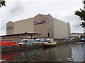
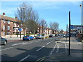
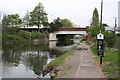
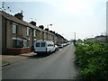
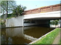
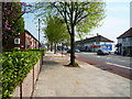
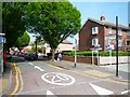
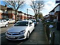
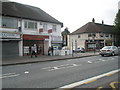
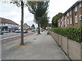
Living in Southall West Ward means residing in a densely populated urban area within the London Borough of Ealing. This electoral ward, established for the 2022 elections, covers exactly 82.6 hectares and sits at coordinates 51.509°N, 0.389°W. It forms part of the larger Ealing Southall parliamentary constituency and falls under the UB1 postcode district. You will find yourself in a well-connected location that benefits from proximity to Southall Broadway, a major shopping and dining destination known for its South Asian shops, restaurants, and festivals. Minet Country Park provides nearby open green space for residents seeking a break from the urban density. The Elizabeth Line runs close by, offering direct links to Heathrow Airport and central London. The area has a population of 6,581 residents according to 2021 census data. This figure reflects a compact community where daily life is shaped by a vibrant multicultural character. You are surrounded by independent businesses and services that cater to both the local population and visitors. The ward elects two councillors to Ealing Council, giving you a voice in local governance. While the broader Southall area has a longer administrative history, Southall West Ward specifically is a relatively new electoral division. Your daily routine will involve navigating an area that combines urban intensity with cultural vitality. The neighbourhood acts as a hub for community activity without relying on generic marketing terms. Instead, it stands as a distinct part of West London with its own identity built on diversity and connection to wider transport networks.
- Area Type
- District Borough Unitary Ward
- Area Size
- 82.6 hectares
- Population
- Not available
- Population Density
- Not available
Demographics
The community in Southall West Ward is defined by a notably diverse ethnic composition. According to 2021 census data, the population consists primarily of Asian residents, with 4,965 individuals representing approximately 75% of the total population. Another 536 residents identified as Black, while 596 belong to other ethnic groups. There are also 305 White residents, 57 Arab residents, and 124 people from mixed or multiple ethnic backgrounds. This demographic mix creates a rich social fabric within the ward. You will encounter a residential environment that reflects this variety. The ward has a population of 6,581 residents, making it a moderately sized community within the London Borough of Ealing. The median age for the population is 70 years, suggesting an area where many long-term residents continue to live well into their later years. Home ownership stands at 48%, indicating that slightly fewer than half of the households own their homes outright or with a mortgage. The remaining households likely comprise private rentals, social housing, or other accommodation types. The specific household composition breakdown is not detailed in the current statistics. However, the age profile and ownership figures point to a specific living pattern in this ward. You should consider how the multi-ethnic nature of the area influences local schools, shops, and community groups. The high representation of Asian residents aligns with the reputation of the broader Ealing Southall constituency for its cultural vibrancy. Living here means engaging with a community where your neighbours reflect the decisions made decades ago regarding migration and settlement in West London. These facts provide a clear picture of who calls Southall West Ward home.
Household Size
Accommodation Type
Tenure
Ethnic Group
Religion
Household Composition
Age
Household Deprivation
NS-SEC
Explore more demographic insights in this area
Go to Demographics tabPlanning
Planning Constraints
- Flood RiskPremium
- Ramsar Wetland SitesPremium
- Area of Outstanding Natural BeautyPremium
- Protected Nature ReservePremium
- Protected WoodlandPremium
- Crime RiskPremium