Area Overview for South Norwood Ward
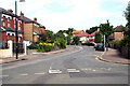
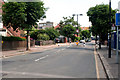
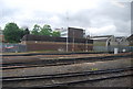
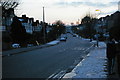
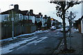
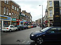
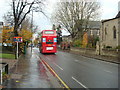
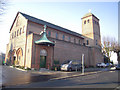
Photos of South Norwood Ward
Area Information
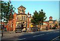
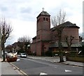
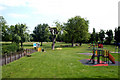
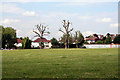
South Norwood Ward is an electoral ward located in the London Borough of Croydon. It covers a distinct district within South London that sits on the border with Greater London and formerly Surrey. This small area spans just 2.1 km² yet holds a population of approximately 5,814 people. The density reaches 2,716 people per square kilometre, creating a compact living environment where residents are in close proximity. History books note that the area evolved from a hamlet in 1848 following road construction and the enclosure of common lands. The 1860s saw significant growth when William Ford Stanley established a precision instrument factory nearby. Today, the ward remains a defined community anchored by historical landmarks such as Stanley Halls and Holy Innocents Church. Living in South Norwood Ward means accessing a space with deep roots in the region's industrial past. The area is situated at coordinates 51.398166, -0.079347, near the historic South Norwood Lake which was originally a reservoir for the Croydon Canal. Norwood Junction Station, which opened in 1856, continues to serve as a key transport hub developed alongside the Crystal Palace lines. You find yourself surrounded by infrastructure that has shaped the neighbourhood for over a century and a half. The ward offers a blend of residential peace and historical significance within a relatively small footprint.
- Area Type
- District Borough Unitary Ward
- Area Size
- 2.1 km²
- Population
- 5814
- Population Density
- 2716 people/km²
Demographics
The community profile in South Norwood Ward leans heavily towards older adults. The median age of residents is recorded at 70 years old, making this one of the oldest areas in the local borough. Analysis of household composition indicates a population structure typical of retirement locations or municipalities with long-term established families. Only 41% of households report owning their homes outright. This figure suggests that more than half of the residents are renters or privately renting within the ward. The area accommodates a total population figure of 5,814 individuals across its limited geography. Diversity metrics within the ward are present but not heavily detailed in current public figures. The demographic makeup reflects a settled community with a clear age predominance. You should note that the higher home ownership percentage found in similar older areas often drops in specific wards like this where one in two households rents. This dynamic influences local investment strategies and community engagement levels. The age distribution means services may cater specifically to those needing support in their later years. Residents should expect neighbours in the 70-year-old bracket to be a common sight throughout the streets of South Norwood Ward.
Household Size
Accommodation Type
Tenure
Ethnic Group
Religion
Household Composition
Age
Household Deprivation
NS-SEC
Explore more demographic insights in this area
Go to Demographics tabPlanning
Planning Constraints
- Flood RiskPremium
- Ramsar Wetland SitesPremium
- Area of Outstanding Natural BeautyPremium
- Protected Nature ReservePremium
- Protected WoodlandPremium
- Crime RiskPremium