Area Overview for South Hornchurch Ward
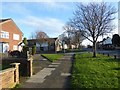
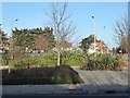
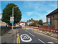
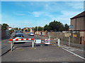
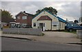
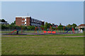
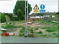
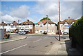
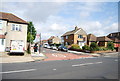
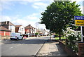
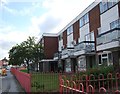
Photos of South Hornchurch Ward

Area Information
South Hornchurch Ward represents a distinct residential zone within northeast London, covering an area of just 3.0 square kilometres. This small ward is located in the southeast of the London Borough of Havering and sits on the boundary of Greater London. The population stands at 10,884 residents, which means the community remains tightly knit within such a concentrated space. The ward has existed since the creation of the London Borough of Havering on 1 April 1965. It underwent three significant boundary revisions in 1978, 2002, and 2022. The most recent 2022 revision reduced the ward's territory by transferring areas to Rainham, Wennington, and the new ward of Beam Park. This reduction also decreased the number of councillors representing the area from three to two. Despite these political shifts, the ward continues to cover the South Hornchurch neighbourhood. The southern section includes the industrialised Hornchurch Marshes area adjacent to the River Thames. This location places the ward within the London Riverside section of the Thames Gateway redevelopment area, identifying it as a site of increasing development and population change. Living in South Hornchurch Ward means residing in an area defined by its proximity to the river and its history of administrative evolution. You should expect a community that balances historical industrial roots with modern redevelopment projects. The ward extends northwards from the River Thames, creating a defined geographic character for daily life.
- Area Type
- District Borough Unitary Ward
- Area Size
- 3.0 km²
- Population
- Not available
- Population Density
- Not available
Demographics
The community in South Hornchurch Ward displays a very specific age profile with a median age of 70. This figure indicates a population dominated by older residents. The most common age range recorded in the data is listed as Age: Total, suggesting the demographic spread clusters heavily in the senior cohort. Home ownership stands at an impressive 75 per cent, which is significantly higher than the national average for London. This high rate of ownership suggests the area is established and populated by long-term residents who have built their equity over time. Household composition and accommodation type data are recorded in the central totals, reflecting the settled nature of the zone. The predominant ethnic group and religious affiliation data are available for the ward as whole statistics. These demographics paint a picture of a mature neighbourhood where families may have moved years ago or where elderly couples remain. With home ownership at three-quarters of all dwellings, the rental market plays a smaller role in daily life. The concentration of older residents influences local services and social interactions. Children and young adults form a smaller portion of the daily population compared to many other parts of London. The community feel is likely shaped by this older demographic, with social developments catering to retirees and established families.
Household Size
Accommodation Type
Tenure
Ethnic Group
Religion
Household Composition
Age
Household Deprivation
NS-SEC
Explore more demographic insights in this area
Go to Demographics tabPlanning
Planning Constraints
- Flood RiskPremium
- Ramsar Wetland SitesPremium
- Area of Outstanding Natural BeautyPremium
- Protected Nature ReservePremium
- Protected WoodlandPremium
- Crime RiskPremium