Area Overview for South Balham Ward
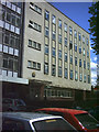
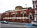
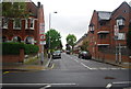
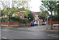
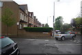
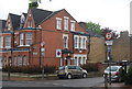
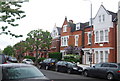
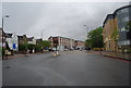
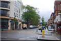
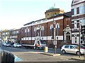
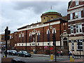
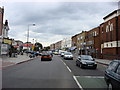
Photos of South Balham Ward
Area Information
South Balham Ward defines itself within the Greater London Borough of Lambeth as a compact district covering just 1.5 square kilometres. Despite its small footprint, the area accommodates a population of 2,917 residents, resulting in a density of 1,906 people per square kilometre. Living in South Balham Ward means navigating a tightly knit environment where daily life is concentrated. The ward represents a specific slice of London where residents benefit from limited space but significant community interaction. You will find yourself in an area where every square metre is shared by many. This density influences the character of daily routines, from local shop access to public transport usage. The ward sits firmly within the broader South London context, offering a neighbourhood experience that prioritises proximity over sprawl. When you consider homes in South Balham Ward, you are stepping into a defined geographic zone with clear boundaries and a focused resident base. The small area size ensures that distances to local amenities are short, reducing the need for extensive travel for basic requirements. This concentration creates a distinct lifestyle compared to more sprawling suburbs. Your time spent commuting across the ward is minimal, allowing you to focus more on your immediate surroundings and local connections.
- Area Type
- District Borough Unitary Ward
- Area Size
- 1.5 km²
- Population
- 2917
- Population Density
- 1906 people/km²
Demographics
The community profile of South Balham Ward reveals a notably older demographic structure compared to the national average. The median age stands at 70 years, indicating a population composed largely of senior residents. Within South Balham Ward, this age profile suggests a quieter neighbourhood atmosphere dominated by retirees. Household composition reflects this maturity, with families and young professionals being less common than empty-nester households or singles. Home ownership remains a significant factor in the local living arrangements, with 44% of residents owning their homes outright or with a mortgage. This figure suggests a stable resident base rather than a transient population frequently moving in and out of rental properties. While specific data on ethnic diversity and religious affiliation are not detailed in the current records, the age distribution provides the most concrete insight into the social fabric. Present commercial activity and local services likely cater to the needs of this older demographic. When you evaluate living in South Balham Ward, consider that the social year-round activities may align with the interests of an established, mature crowd. The 44% ownership rate provides a moderate sense of stability within the community, balancing the needs of those who own against those who rent.
Household Size
Accommodation Type
Tenure
Ethnic Group
Religion
Household Composition
Age
Household Deprivation
NS-SEC
Explore more demographic insights in this area
Go to Demographics tabPlanning
Planning Constraints
- Flood RiskPremium
- Ramsar Wetland SitesPremium
- Area of Outstanding Natural BeautyPremium
- Protected Nature ReservePremium
- Protected WoodlandPremium
- Crime RiskPremium